Ahmedabad DP 2021
Core idea
TP schemes, ring road, BRT
Why it matters
Land pooling exemplar in India
Description
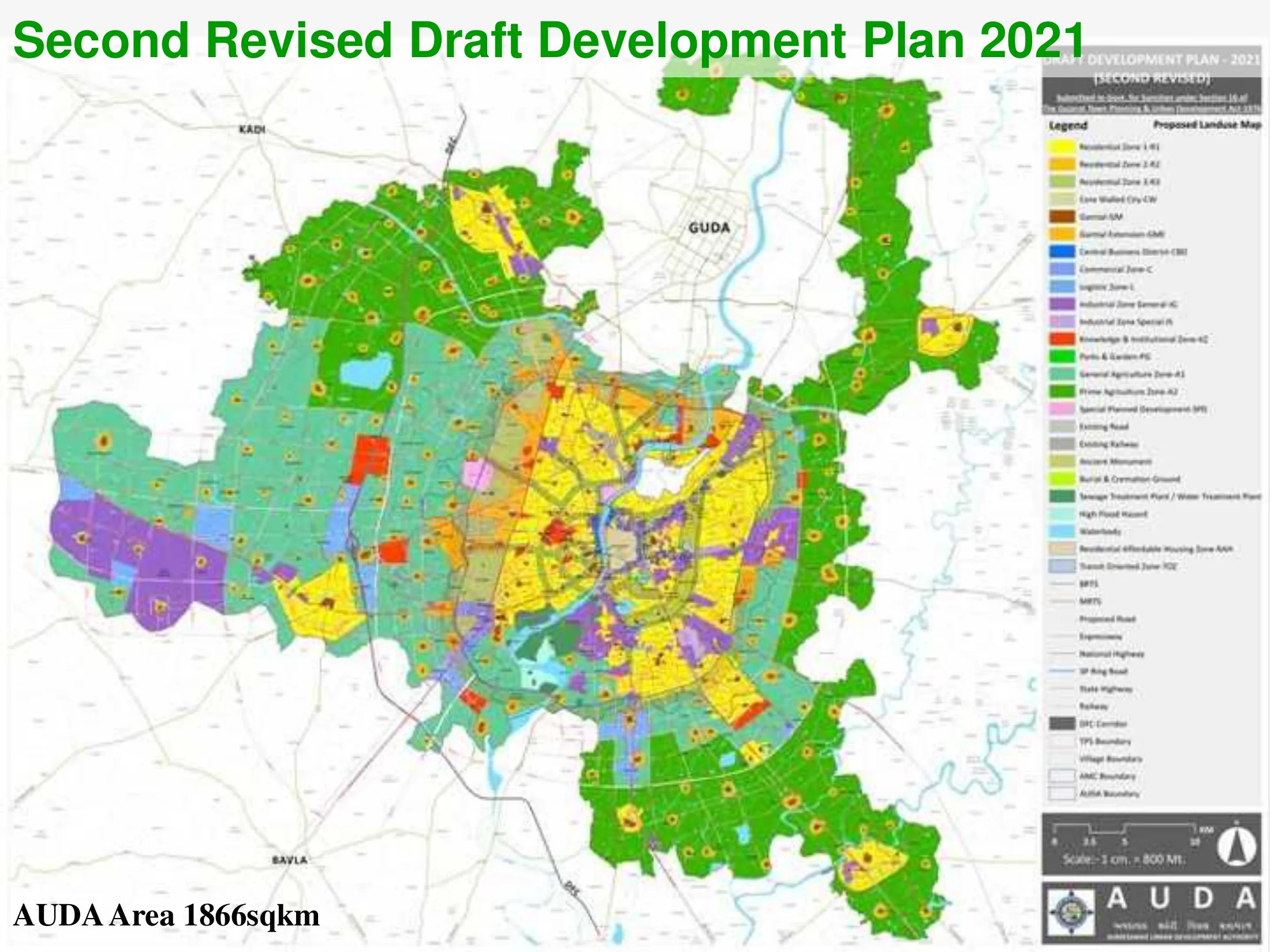
The Ahmedabad Development Plan 2021, sanctioned in 2014 and prepared by the Ahmedabad Urban Development Authority, is the statutory development plan for the Indian city's metropolitan area. Its core instruments are Town Planning Schemes, the Gujarati land-pooling and readjustment mechanism used to assemble and service urban expansion land, combined with the Sardar Patel Ring Road, the Janmarg bus rapid transit system, and higher development intensities along transit corridors and in the central city. It also introduced zones for affordable housing and transit-oriented development.
Significance
The plan is widely regarded as the leading Indian demonstration of land pooling as an alternative to compulsory acquisition, and Ahmedabad's Town Planning Scheme practice has been promoted nationally and internationally as a replicable model. Together with the Janmarg BRT, it positioned Ahmedabad as a reference city for Indian urban reform, though critics note uneven implementation and questions of equity in land readjustment.
What shaped it
- Adickes Law — land readjustment (1902)
- Bus Rapid Transit (BRT) (1974)
- The master plan (early 20th c.)
Sources
- https://www.auda.org.in/RDP/
- https://deshgujarat.com/2013/02/07/audas-2nd-cty-draft-development-plan-2021-for-ahmedabad/