Amsterdam Structuurvisie 2040
Core idea
Polycentric growth, intensification corridors
Why it matters
Long-horizon city development strategy
Description
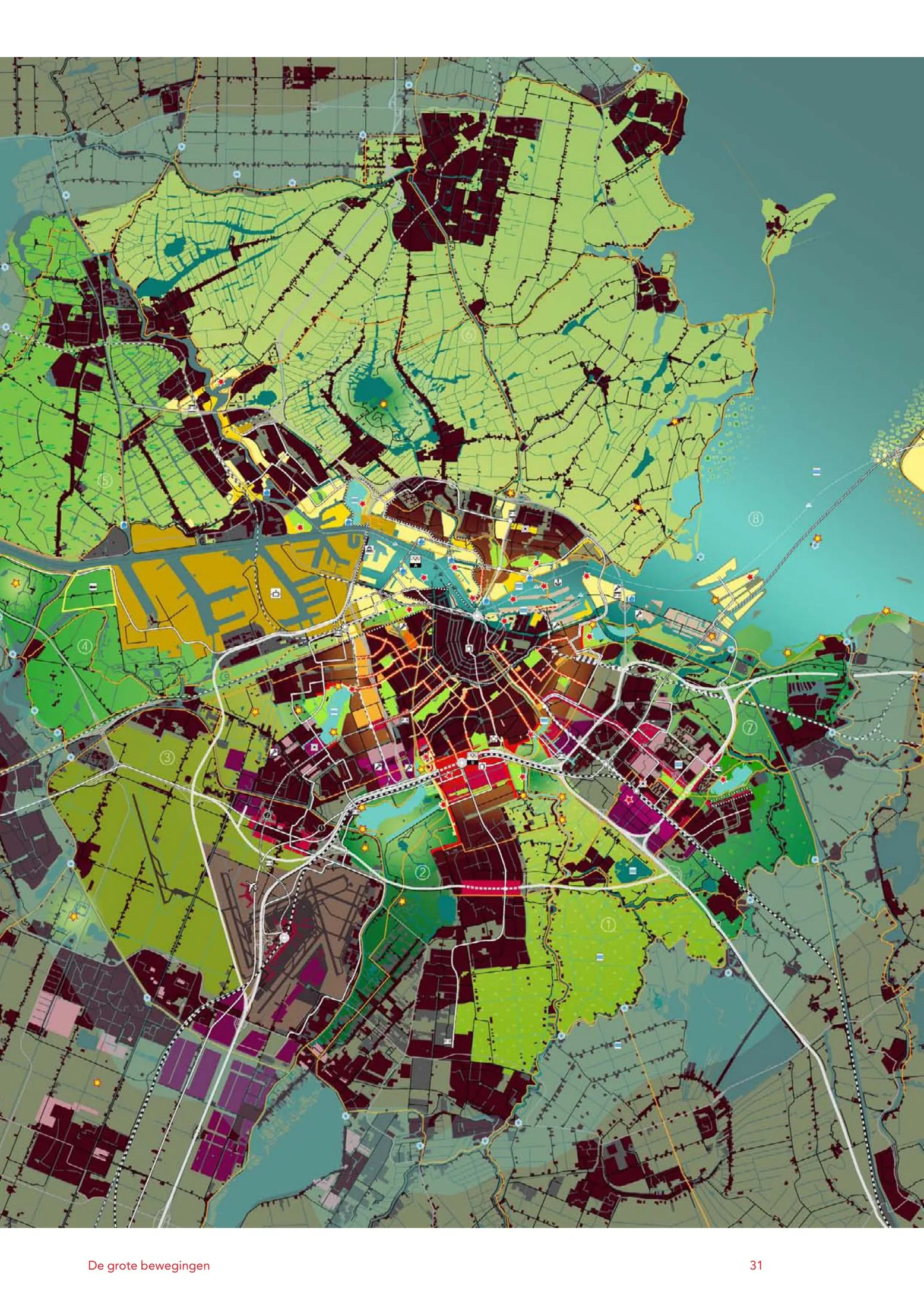
The Structuurvisie Amsterdam 2040, adopted by the Gemeente Amsterdam in 2011, is a long-horizon structural vision for the city's spatial development. It steers growth through densification within the existing city, extension of the centre's qualities outward across the ring road, intensification corridors and waterfront development along the IJ, and a polycentric conception of the metropolitan region, while protecting green wedges and investing in public transport.
Significance
The vision marks the consolidation of Dutch strategic planning at municipal level after the retreat of strong national frameworks, and its 'roll-out of the centre' idea shaped a decade of intensive infill development. It is frequently cited in European debates on compact-city strategy, and retrospectively in discussions of the housing pressure and gentrification that accompanied Amsterdam's densification.
What shaped it
- The compact city (1973-1990s)
- Transit-oriented development (TOD) (1993)
- Planetary urbanisation (Brenner & Schmid) (2011-2014)
Sources
- https://openresearch.amsterdam/en/page/42693/amsterdam-structuurvisie-2040
- https://zoek.officielebekendmakingen.nl/stcrt-2011-7268.html