Arnhem–Nijmegen City Region SDF
Core idea
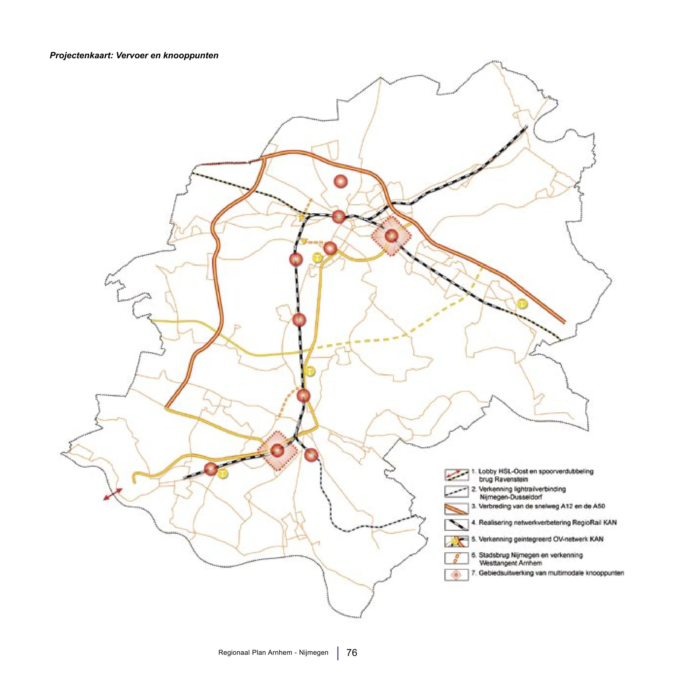
Rail nodes + river crossings
Why it matters
Twin-city regional coordination
Description
The 2013 spatial development framework for the Arnhem-Nijmegen city region in the eastern Netherlands was prepared by the Stadsregio Arnhem Nijmegen, the statutory city-regional cooperation body for some twenty municipalities around the twin cities. It coordinated growth around the rail network's station nodes, including the corridor between the two cities, and addressed the great rivers crossing the region, aligning housing, employment locations and mobility investment such as the RegioRail/Sprinter services and new river crossings. It provided a shared framework in a polycentric region of about three-quarters of a million people, shortly before Dutch city-regions lost their statutory status in 2015.
Significance
The framework is a characteristic product of Dutch regional planning culture: soft-space coordination of two competing medium-sized cities into a single polycentric labour and housing market structured by rail nodes and river landscapes. It illustrates the node-and-place approach to regional transit-oriented development that the Netherlands helped codify. It also marks the final generation of plans by the statutory Dutch stadsregio's before their abolition, a point of reference in debates on metropolitan governance.
What shaped it
- Transit-oriented development (TOD) (1993)
- The master plan (early 20th c.)
- The compact city (1973-1990s)
Sources
- https://nl.wikipedia.org/wiki/Stadsregio_Arnhem_Nijmegen
- https://wiki.ovinnederland.nl/wiki/Stadsregio_Arnhem-Nijmegen