Athens Regulatory Plan
Core idea
Green structure and growth directions
Why it matters
Framework for Attica region
Description
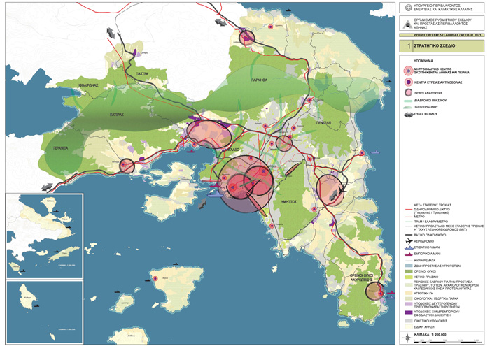
The Athens Regulatory Plan of 1985, revised in 2014, is the statutory strategic framework prepared by the Greek state for the metropolitan area of Athens and the wider Attica region. It set out intended growth directions, a polycentric structure of centres, and a green framework linking the mountain ranges and coastal zones that contain the basin, alongside environmental protection measures for a city suffering severe smog and congestion. The 2014 revision reoriented the framework towards sustainability, urban regeneration and the post-crisis economy.
Significance
The plan gave Greece's dominant metropolitan region its principal instrument of strategic coordination, in a planning culture historically marked by weak plan implementation and extensive unauthorised building. Its fortunes illustrate both the value and the fragility of metropolitan frameworks in southern Europe, where regulatory plans compete with clientelist land politics, and the 2014 revision is studied as an attempt to steer an austerity-era metropolis.
What shaped it
- The green belt (1898 concept / 1938 law)
- The master plan (early 20th c.)
- Zoning (1884 Germany / 1916 NYC)
Plans it influenced
- Athens Strategic Plan 2030 (2017)
Sources
- https://www.athenssocialatlas.gr/en/article/spatial-planning/
- https://www.athenssocialatlas.gr/en/article/metropolitan-governance/