Austin Imagine Austin
Core idea
Centers and corridors + Project Connect
Why it matters
Tech boomtown managing growth
Description
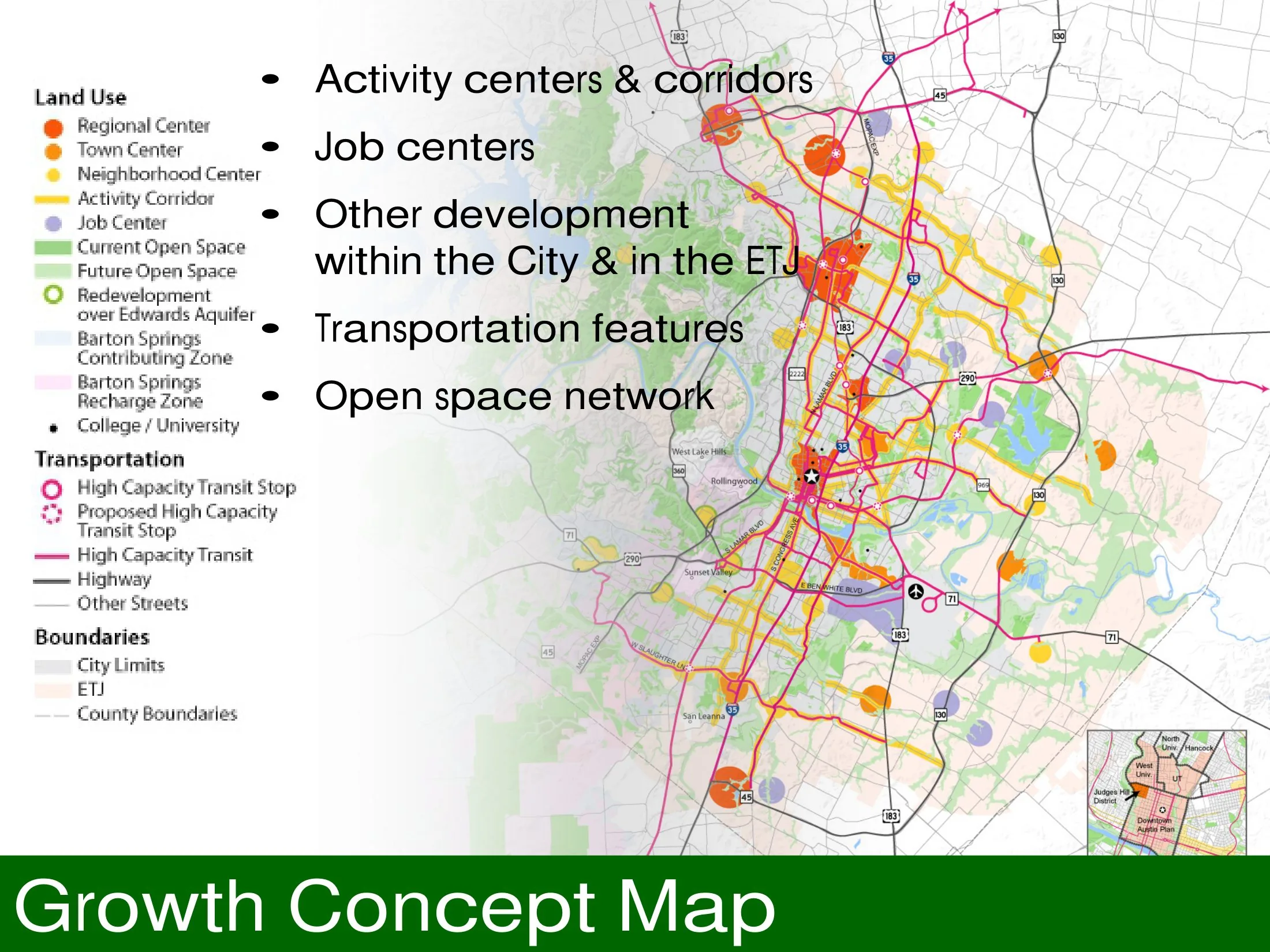
Imagine Austin, the comprehensive plan adopted by the City of Austin in 2012 after an extensive public engagement process. The plan organises growth around a network of activity centres and corridors, promoting a compact and connected city in place of continued low-density sprawl, and it anticipated the transit investment later pursued as Project Connect. It covers land use, mobility, environment and economy for a rapidly growing technology-driven city.
Significance
Imagine Austin is a prominent example of a Sunbelt boomtown attempting to redirect growth inward through a centres-and-corridors strategy. Its implementation struggles, most visibly the failure of the CodeNEXT land development code rewrite, have made it a much-discussed case in American debates over the gap between comprehensive plan visions and zoning reform.
What shaped it
- Transit-oriented development (TOD) (1993)
- The Next American Metropolis / Charter of the New Urbanism (1993 / 1996)
- The compact city (1973-1990s)
- Communicative & collaborative planning (1989-1997)
Sources
- https://www.adaptationclearinghouse.org/resources/imagine-austin-comprehensive-plan.html
- https://www.wrtdesign.com/projects/imagine-austin