Ayutthaya (Siamese Island Capital)
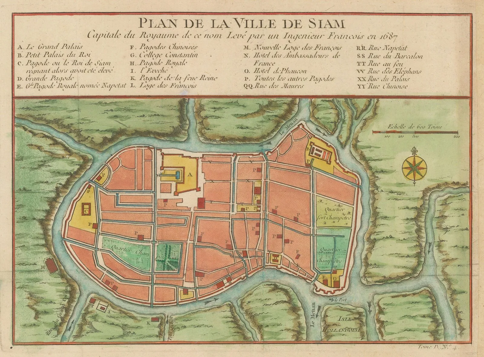
Core idea
Grid-and-canal hydraulic capital on a river-island at the confluence of three rivers.
Why it matters
An advanced indigenous water-managed grid city that became one of the world's largest.
Description
Ayutthaya was founded in 1351 by King Uthong, crowned Ramathibodi I, who established his capital on an island formed by the confluence of the Chao Phraya, Pa Sak and Lopburi rivers. The city was laid out on a systematic planning grid of roads, canals and moats organising its palaces, temples and quarters, supported by an unusually advanced hydraulic system for transport, flood control and water supply. Exploiting its position amid three rivers, this network made Ayutthaya a defensible and prosperous trading capital that endured for over four centuries and grew into one of the largest cities of its era, until its destruction by Burmese forces in 1767. The ruins are now a UNESCO World Heritage Site.
Significance
Ayutthaya demonstrates sophisticated indigenous Southeast-Asian urbanism: a rigorously planned grid integrated with a canal-and-moat hydraulic system that turned a river-island into a major cosmopolitan capital. Its water engineering and ordered layout influenced later Thai city-building, most directly the founding of Bangkok. As one of the world's largest cities of the 17th century and a World Heritage Site, it remains central to the history of pre-modern Asian planning.
What became of it
Sacked and burned by the Burmese in 1767, ending its role as capital; never rebuilt as the capital (the seat moved downriver to Bangkok), leaving the river-island grid of temples, palaces and canals as ruins now protected as a historic park.
Critique
The headline c.1-million-by-1700 'world's largest city' claim is a contested upper-bound estimate that some scholars consider inflated relative to firmer ~300,000 figures.
What shaped it
- The grid (c. 2500 BCE)
- Temple-tank and eri (tank) irrigation hydraulics (c. 9th c. CE onward)
- Buddhism (c. 5th c. BCE)
- Vastu Shastra / Mayamata / Manasara (c. 6th c. CE)