Bangkok Comprehensive Plan 2013
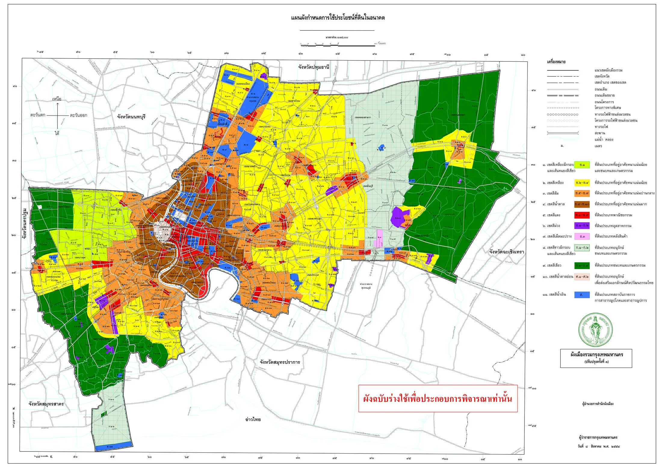
Core idea
Land-use zoning + flood resilience
Why it matters
Statutory plan for a delta metropolis
Description
The Bangkok Comprehensive Plan of 2013 is the statutory land-use plan for the Thai capital, prepared by the Bangkok Metropolitan Administration (BMA) as the third-generation comprehensive plan under Thailand's town planning law. It zoned the metropolis by density and use, encouraged higher-intensity development around mass transit stations through floor-area incentives, and incorporated flood-management measures, including protected green and agricultural floodway areas in the eastern periphery, following the severe 2011 Chao Phraya floods. It regulates development across a low-lying delta metropolis of over eight million people.
Significance
The plan is significant as an attempt to bring statutory order and flood resilience to one of Southeast Asia's largest and most flood-exposed megacities, marking a shift towards linking land use with the expanding rail transit network. Its floodway protections and density bonusing entered regional debates on delta urbanism after 2011, though enforcement gaps and the persistence of development in flood-prone zones have been widely criticised. It illustrates both the reach and the limits of master planning in Southeast Asian megacity governance.
What shaped it
- Zoning (1884 Germany / 1916 NYC)
- Urban resilience (2013)
- The master plan (early 20th c.)
Sources
- https://en.wikipedia.org/wiki/Bangkok_Comprehensive_Plan
- https://www.nationthailand.com/news/general/40062056