Birmingham Big City Plan
Core idea
Public realm, Eastside, HS2 interface
Why it matters
Largest UK city center transformation
Description
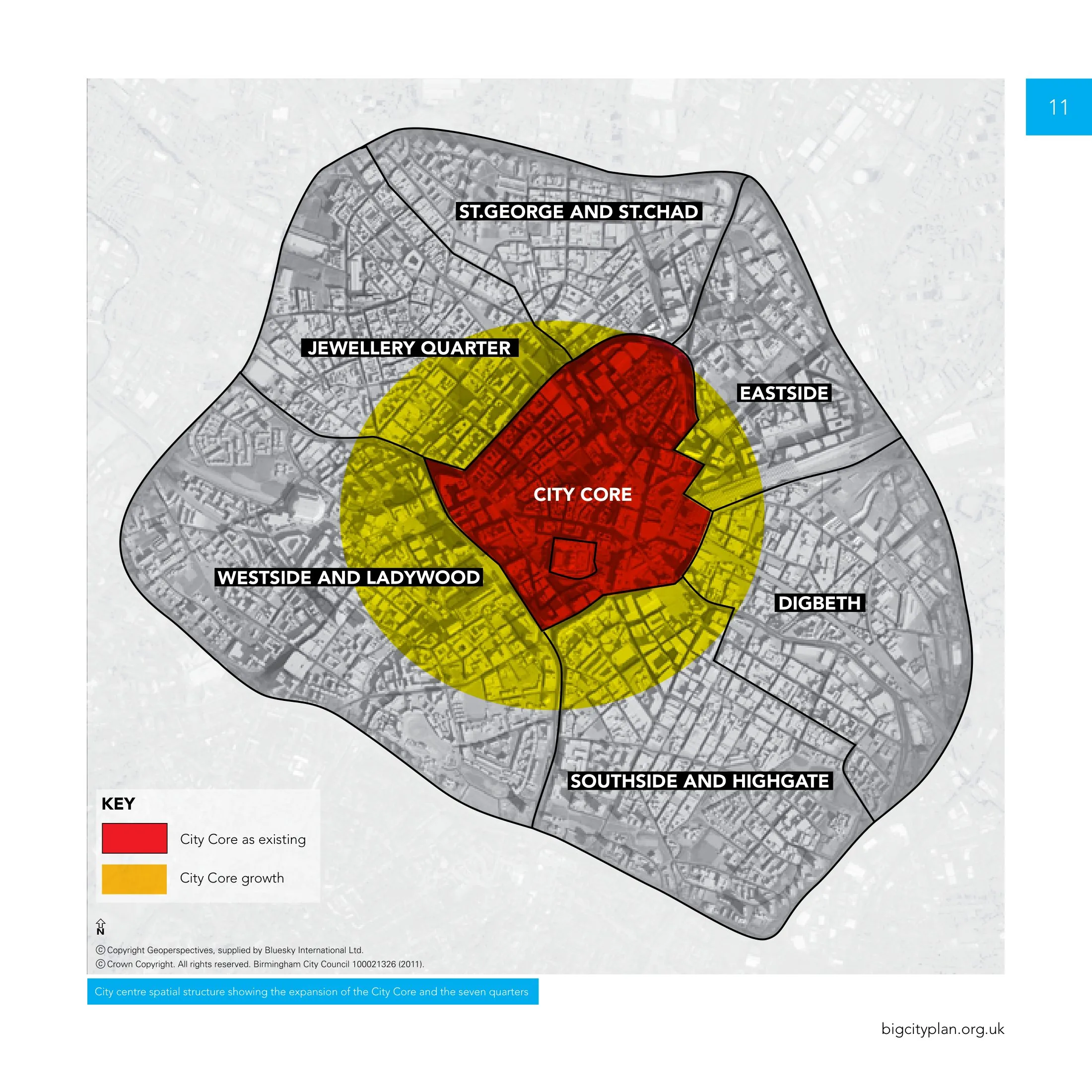
A twenty-year masterplan for central Birmingham adopted by Birmingham City Council in 2010, covering an enlarged city core divided into distinct quarters. Its key moves included a major expansion of the walkable city centre beyond the constricting inner ring road, public realm improvements, the development of the Eastside learning and innovation quarter, and preparation for the arrival of the HS2 high-speed rail terminus at Curzon Street. The plan guided schemes such as the redevelopment of Paradise and the transformation of New Street station's surroundings.
Significance
The Big City Plan is regarded as the framework behind one of the largest city centre transformations in the United Kingdom, restoring confidence in Birmingham's core after decades of ring-road-bound decline. It is frequently cited as an example of a non-statutory but effective city centre vision, and its coupling of public realm strategy with a high-speed rail interface influenced how other UK cities planned around HS2.
What shaped it
- Transit-oriented development (TOD) (1993)
- The compact city (1973-1990s)
Sources
- https://www.architectsjournal.co.uk/archive/best-2010-the-big-city-plan
- https://en.wikipedia.org/wiki/Big_City_Plan