Bordeaux Euratlantique
Core idea
HSR-led expansion & riverfront projects
Why it matters
Intercity rail as urban catalyst
Description
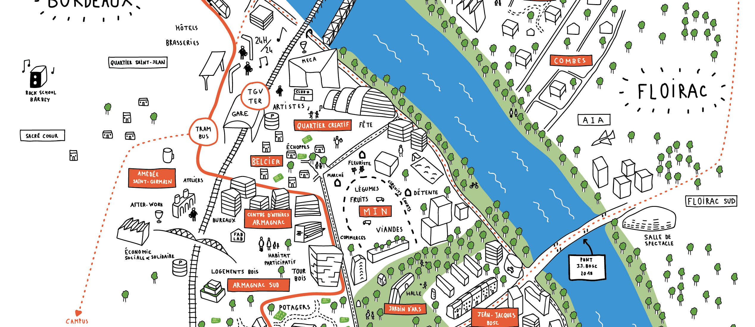
Bordeaux Euratlantique is a large French urban development operation launched in 2009 and steered by a dedicated public agency, EPA Euratlantique, under the national Opération d'Intérêt National framework. It uses the arrival of the high-speed rail line connecting Bordeaux to Paris as the trigger for redeveloping extensive railway and industrial land around Saint-Jean station and along the Garonne riverfront, on both banks. The programme combines new business districts, housing quarters and public spaces across several hundred hectares in Bordeaux, Bègles and Floirac.
Significance
Euratlantique is a leading European example of high-speed rail as a catalyst for metropolitan restructuring, extending the French tradition of state-led grands projets to a regional capital. It has informed debates on whether station-district development genuinely spreads growth beyond Paris or merely concentrates it around infrastructure nodes, and on the balance between office-led development and affordable housing in regeneration areas.
What shaped it
- Transit-oriented development (TOD) (1993)
- World becomes majority urban (2007)
- Global financial crisis (2007–2009)
- The compact city (1973-1990s)
Sources
- https://fr.wikipedia.org/wiki/Bordeaux-Euratlantique
- https://www.bordeaux-metropole.fr/metropole/projets-en-cours/developpement-economique-innovation