Caernarfon
Core idea
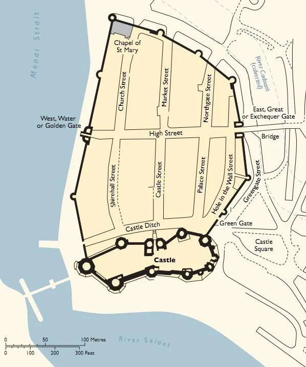
Castle-and-walled-town built together as a single act of conquest — a gridded English borough planted beside a monumental castle to dominate conquered Wales
Why it matters
The clearest example of colonial-military urbanism in medieval Europe; Edward I's Welsh "bastides" fused fortress, planted town, and ethnic settlement policy
Description
Built from 1283 as Edward I of England consolidated his conquest of Wales, Caernarfon paired a monumental castle with a gridded, walled English borough planted beside it as a single integrated act of domination. The town was settled with English burgesses, its banded masonry deliberately evoking imperial Constantinople.
Significance
Caernarfon is the clearest medieval European example of colonial-military urbanism: fortress, planned town, and settlement policy fused to hold conquered territory. Edward I's ring of Welsh castle-towns is a textbook case of urbanism as an apparatus of conquest.
What became of it
Built largely as intended 1283-1292 as a planned English grid borough beside the castle, with Welsh barred from living inside; the walls and street pattern survive substantially intact and form part of the 'Castles and Town Walls of King Edward in Gwynedd' UNESCO World Heritage Site, though the town long outgrew its walls.
Critique
Often read as a tool of colonial domination - an English plantation imposed on conquered Gwynedd that deliberately excluded the native Welsh.
What shaped it
- The grid (c. 2500 BCE)
- The Crusades (1096–1291)
- Magna Carta (1215)
- De Architectura (c. 15 BCE)
Plans it influenced
- Monpazier (1284)