Cagliari Waterfront & Metrotram
Core idea
Tram + waterfront reuse
Why it matters
Island city modern mobility
Description
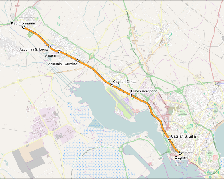
From the 2010s the Comune di Cagliari pursued linked projects to extend the Metrocagliari light-rail/tram network and to regenerate the city's waterfront, including the port frontage of Via Roma and adjacent maritime areas of the Sardinian capital. The programme combines modern tram corridors serving the compact historic city with the reuse of harbour edges for public space, leisure and urban functions.
Significance
The Cagliari case shows how a mid-sized island city adapted mainstream European instruments, light rail and waterfront regeneration, to its own scale and insular condition. It forms part of the broader Italian pattern of port cities renegotiating the boundary between working harbour and urban public realm. While modest compared with Genoa or Naples, it is a useful example of incremental modernisation of mobility and the port-city interface in southern Europe.
What shaped it
- The street tram / streetcar (1832 horse / 1881 electric)
- Landscape urbanism (Waldheim) (1997-2006)
- Transit-oriented development (TOD) (1993)
Sources
- https://www.comune.cagliari.it/portale/page/it/una_promenade_verde_per_il_waterfront_di_cagliari
- https://en.wikipedia.org/wiki/Cagliari_light_rail