Calgary Municipal Dev. Plan/CTP
Core idea
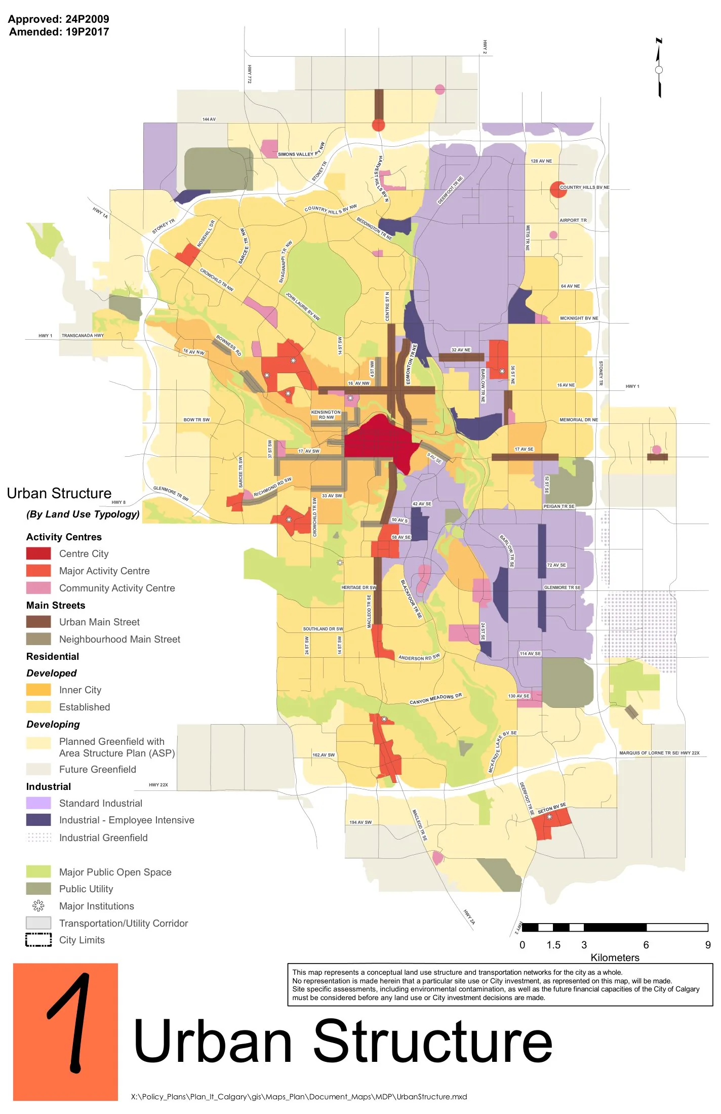
Corridors + primary transit network
Why it matters
Energy city shifts to transit/urban form
Description
The Calgary Municipal Development Plan and its companion Calgary Transportation Plan, adopted together in 2009 and refreshed around 2020, form the city's integrated long-range framework for land use and mobility. Produced by the City of Calgary through the Plan It Calgary process, they direct a growing share of new development into activity centres and corridors served by a primary transit network, marking a deliberate shift away from the low-density annexation-driven growth that had defined the city.
Significance
The paired plans are notable as a self-conscious course correction by a prosperous, car-oriented energy city, embedding transit-oriented intensification targets into statutory policy. They are frequently cited in North American debates on suburban retrofit and on whether integrated land-use and transportation planning can bend entrenched growth patterns in cities built around the automobile.
What shaped it
- Transit-oriented development (TOD) (1993)
- The compact city (1973-1990s)
- Global financial crisis (2007–2009)
- World becomes majority urban (2007)
Sources
- https://www.calgary.ca/content/dam/www/transportation/tp/documents/ctp2009/calgary-transportatio
- https://www.sprawlcalgary.com/calgary-primary-transit-network