Cape Town Municipal Spatial Dev. Framework
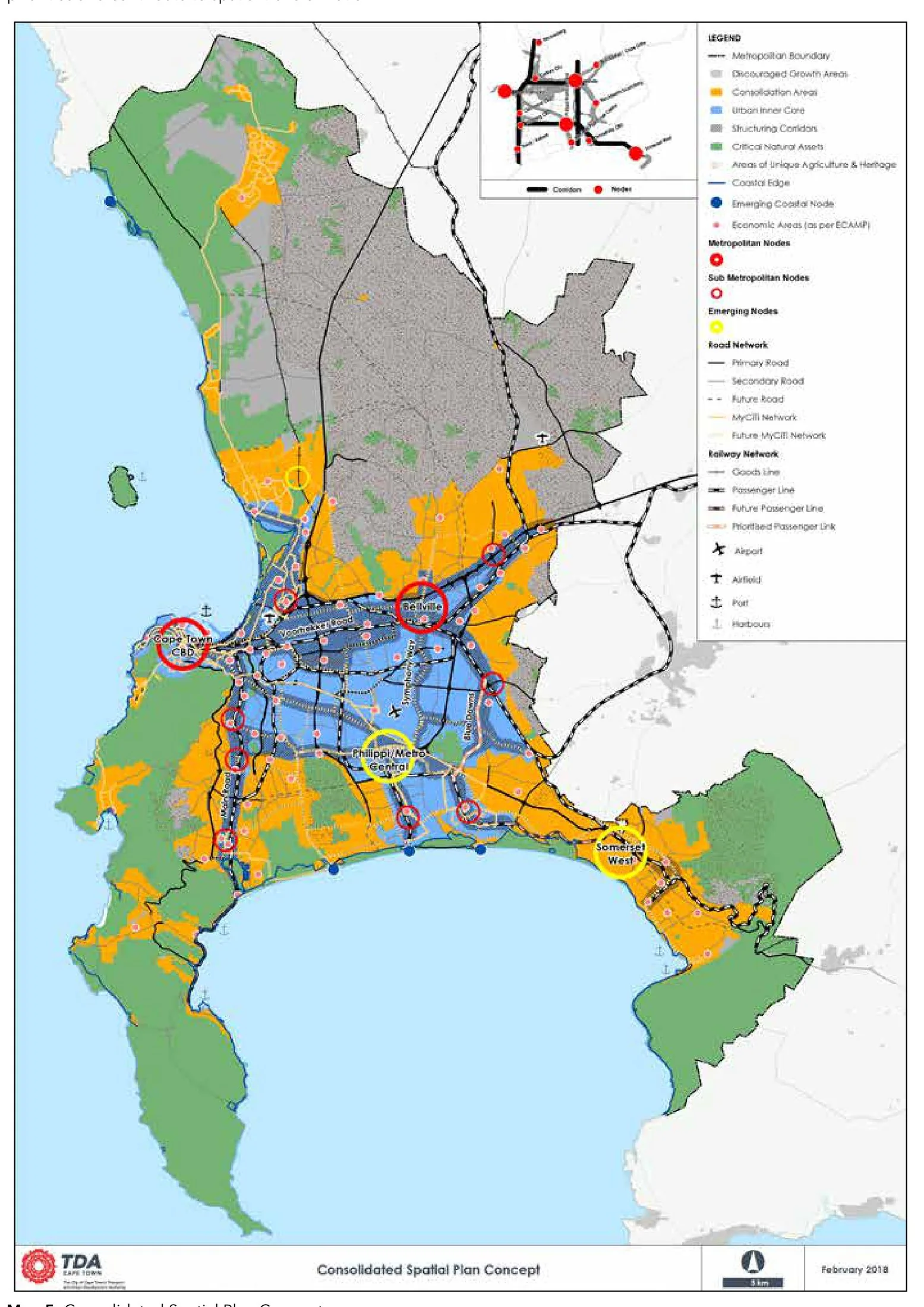
Core idea
Urban edge, corridors, TOD
Why it matters
South African benchmark for SDFs
Description
The Municipal Spatial Development Framework for Cape Town, first adopted in 2012 and substantially revised in 2018 by the City of Cape Town. The framework defines an urban edge to contain sprawl, designates densification and integration corridors, and promotes transit-oriented development along rail and bus rapid transit routes, seeking to restructure a city whose form still reflects apartheid-era segregation. It guides land-use decisions and infrastructure investment across the metropolitan municipality.
Significance
Cape Town's MSDF is regarded as a South African benchmark for the spatial development frameworks required under post-apartheid planning law. It is central to debates on spatial justice, on whether TOD and corridor policies can undo entrenched segregation between well-located wealthy areas and peripheral townships, and on the tension between containment and the pressure for affordable land.
What shaped it
- Transit-oriented development (TOD) (1993)
- The compact city (1973-1990s)
- The green belt (1898 concept / 1938 law)
- The Just City (Fainstein) (2010)
- Postcolonial theory (1978 onward)
Sources
- https://resource.capetown.gov.za/documentcentre/Documents/City%20research%20reports%20and%20revi
- https://resource.capetown.gov.za/documentcentre/Documents/City%20strategies,%20plans%20and%20fra