Chennai Second Master Plan 2026
Core idea
Corridor growth, peri-urban nodes
Why it matters
Structure for a coastal megacity
Description
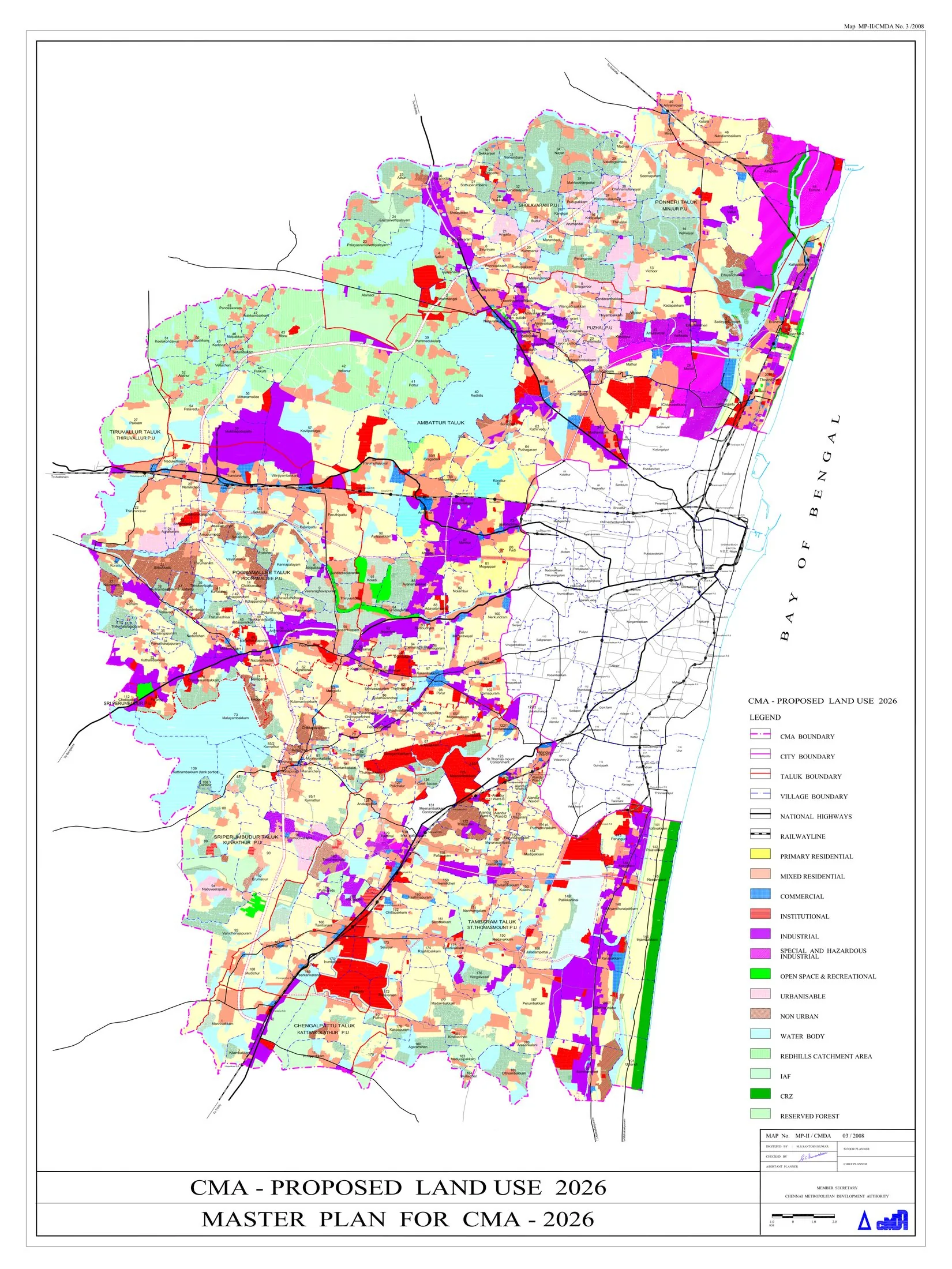
The Second Master Plan for Chennai (horizon 2026), prepared by the Chennai Metropolitan Development Authority and approved in 2008, is the statutory land-use plan for the Chennai Metropolitan Area. It channels growth along radial corridors, promotes peri-urban nodes and satellite growth centres, introduces higher floor-space allowances in selected locations, and addresses infrastructure, housing and transport for a coastal metropolis of many millions.
Significance
As the long-delayed successor to Chennai's first master plan, the Second Master Plan illustrates the persistence of the land-use master plan as the core instrument of Indian metropolitan governance, and its strains under rapid IT-led growth. Its corridor-based structure shaped the expansion of southern Chennai's technology belt, while the 2015 floods and coastal vulnerability have fuelled debate about the plan's treatment of hydrology, wetlands and resilience.
What shaped it
- Transit-oriented development (TOD) (1993)
- The master plan (early 20th c.)
- World becomes majority urban (2007)
- Floor Area Ratio (FAR/FSI) (20th c.)
- Global financial crisis (2007–2009)
Sources
- https://www.cmdachennai.gov.in/smp_main.html
- https://assetyogi.com/chennai-master-plan/
- https://www.researchgate.net/figure/Proposed-Land-use-2026-Source-CMDA-Second-Masterplan-2008_tb