Ciudad Guayana (Joint Center Plan)
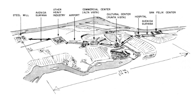
Core idea
A resource-frontier growth-pole city planned while it was already growing
Why it matters
The classic test case of rational planning meeting informal reality
Description
Founded in 1961 at the confluence of the Orinoco and Caroní rivers, Ciudad Guayana was planned by the Corporación Venezolana de Guayana with the MIT–Harvard Joint Center for Urban Studies as a heavy-industry growth pole uniting the company town of Puerto Ordaz and the spontaneous settlement of San Félix along a linear spine, Avenida Guayana.
Significance
Ciudad Guayana became planning literature's most scrutinised experiment in development planning — above all through Lisa Peattie's The View from the Barrio, which contrasted the planners' city seen from the air with the lived city on the ground. It stands for both the ambition and the blind spots of 1960s growth-pole doctrine.
What became of it
Grew into one of Venezuela's largest cities, but the planned east–west integration never fully overcame the divide between planned Puerto Ordaz and popular San Félix.