Cornubia (Durban) Masterplan
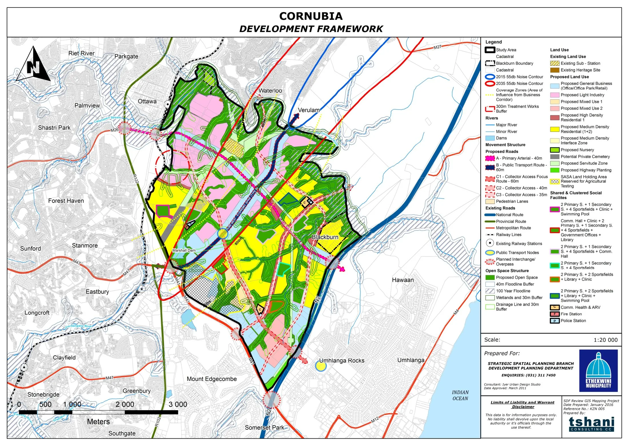
Core idea
Mixed-income housing and logistics
Why it matters
Largest integrated human settlements project in SA
Description
The Cornubia masterplan, initiated in 2011, guides a large mixed-income, mixed-use development on former sugar-cane land north of Durban, South Africa, near Umhlanga. It is a partnership between landowner-developer Tongaat Hulett and eThekwini Municipality, designated a national priority project, combining substantial subsidised and affordable housing with market housing, industrial and logistics platforms, business parks and new road infrastructure. The plan is phased over decades and is among the largest integrated human-settlement projects in the country.
Significance
Cornubia is a leading test of post-apartheid South Africa's 'integrated human settlements' policy, which seeks to break with peripheral, single-class township building by mixing incomes and bringing housing close to employment. Its public–private structure and its location within Durban's northern growth corridor have made it a focus of debate on whether integration is being achieved in practice or whether market logics reproduce separation. It is widely studied as a benchmark for large-scale housing-led urbanism in the region.
What shaped it
- The Just City (Fainstein) (2010)
Sources
- http://thehda.co.za/uploads/Cornubia_fact_sheet.pdf
- https://brandsouthafrica.com/101839/government-services/housing-080414/