El Paso Plan El Paso
Core idea
Form-based smart code, BRT
Why it matters
Border city design-led turnaround
Description
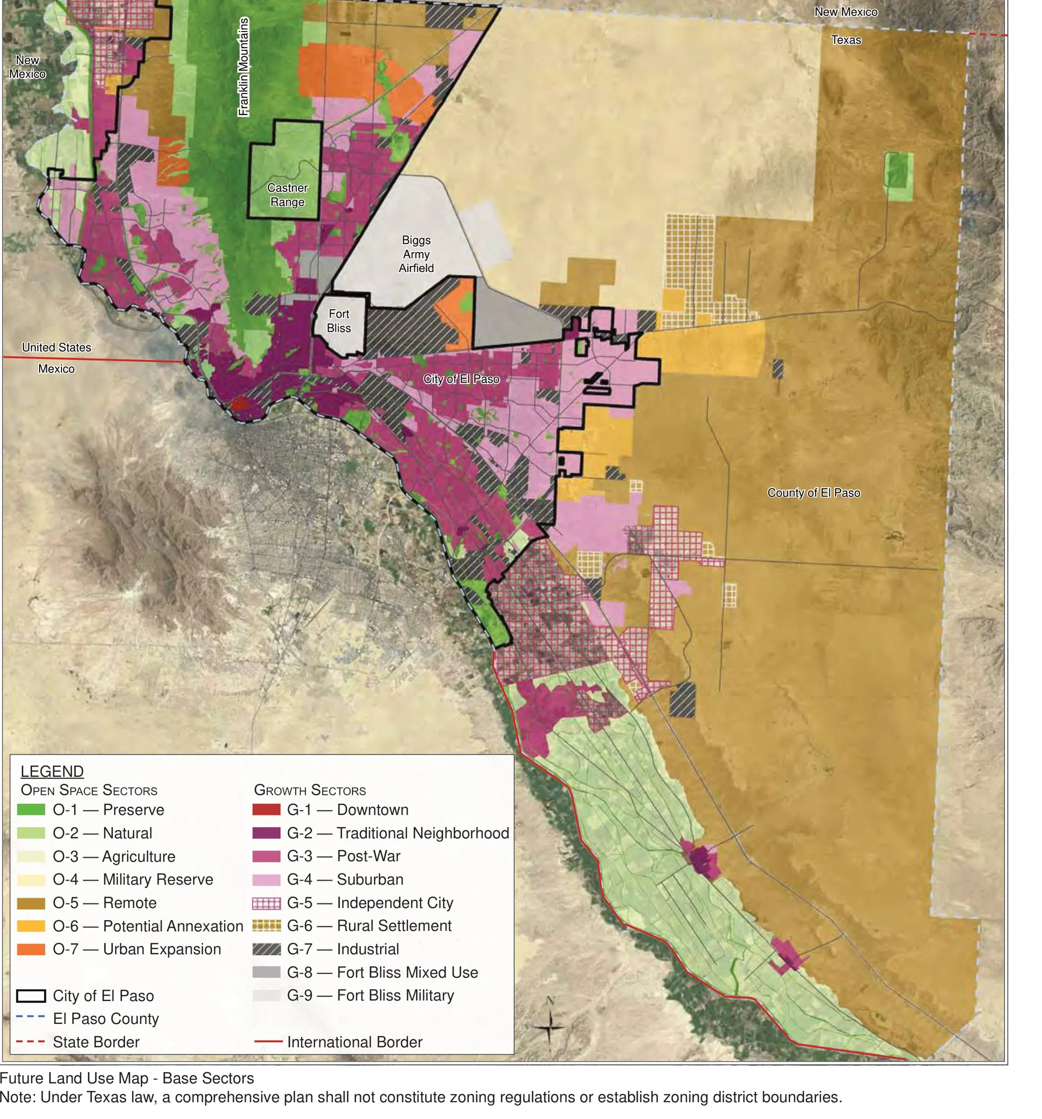
Plan El Paso, adopted in 2012, is the comprehensive plan for the City of El Paso, Texas, prepared by the city with consultants led by Dover, Kohl & Partners. Sitting on the United States side of the US-Mexico border opposite Ciudad Juarez, the plan paired a citywide vision with a form-based SmartCode, walkable infill priorities, and rapid-transit corridors that became the Brio bus rapid transit network. It reoriented a sprawling, automobile-dominated border city towards compact, transit-served development and downtown revitalisation.
Significance
The plan is regarded as one of the strongest American comprehensive plans of its generation, winning national awards from the American Planning Association and serving as a model of New Urbanist and smart-growth principles applied at full municipal scale. It demonstrated that a mid-sized, majority-Latino border city could pursue design-led regeneration rather than continued edge growth. Its pairing of a form-based code with BRT corridors has been widely referenced in debates on retrofitting Sun Belt cities.
What shaped it
- Bus Rapid Transit (BRT) (1974)
- The compact city (1973-1990s)
Sources
- https://www.cnu.org/what-we-do/build-great-places/plan-el-paso
- https://www.elpasotexas.gov/assets/Documents/CoEP/Planning-and-Inspections/Plan-El-Paso/Plan-El-