George Town, Penang (1786 Grid)
Core idea
British gridiron entrepôt with ethnic-quarter plan on the Straits.
Why it matters
First British settlement in Southeast Asia and seed of Straits port urbanism.
Description
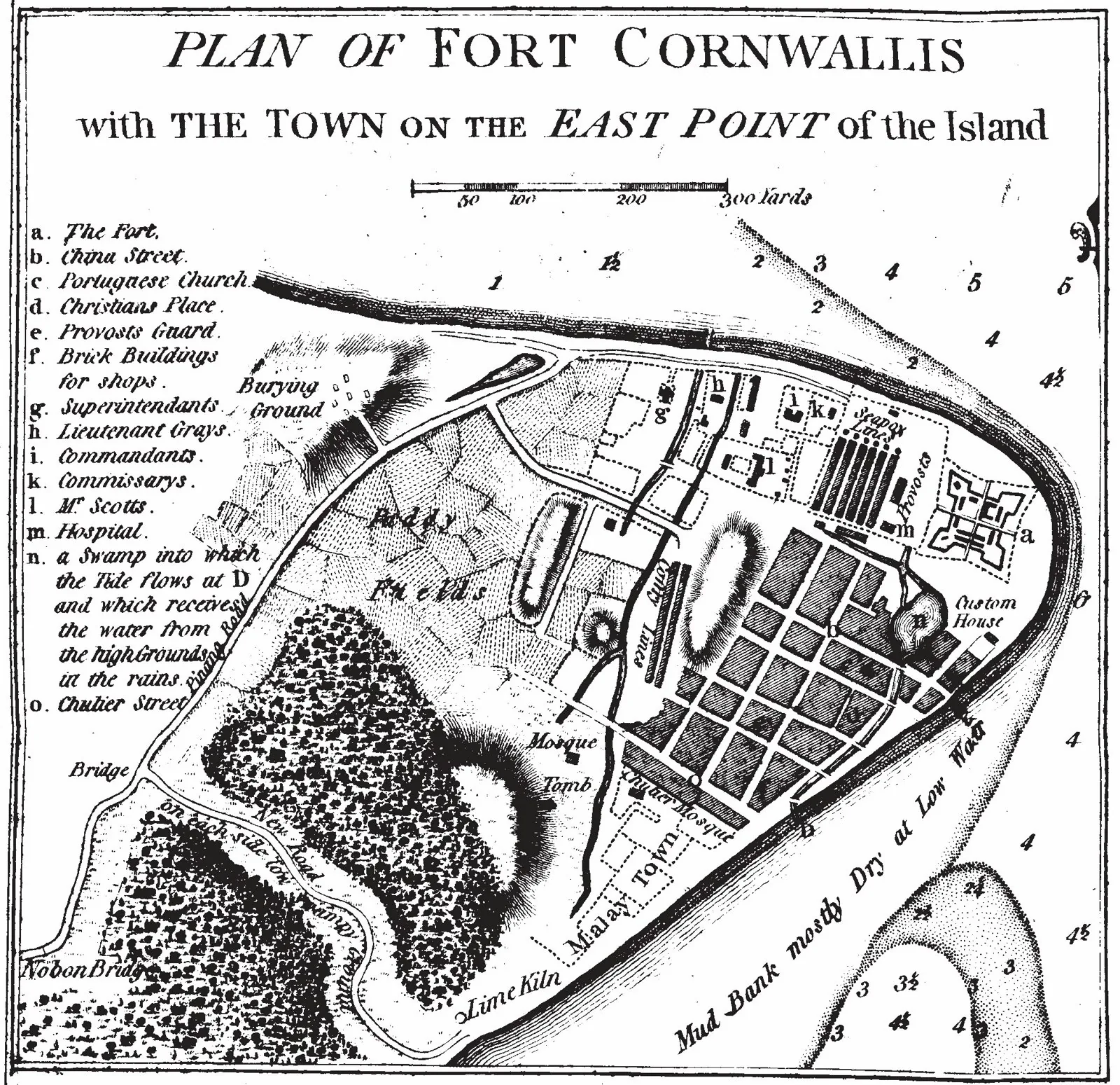
George Town was founded on 11 August 1786 when Francis Light took possession of Penang Island for the British East India Company, naming the settlement for King George III. As the first British settlement in Southeast Asia, it was laid out as a gridiron entrepôt, its original streets, Light, Beach, Chulia and Pitt, set out around Fort Cornwallis. Free-port status drew Malay, Chinese, Indian and European migrants, who settled in distinct ethnic quarters that gave the town its enduring multicultural fabric. This gridded, cosmopolitan plan became a template for later Straits Settlements, and the historic core was inscribed as a UNESCO World Heritage Site, with Melaka, in 2008.
Significance
George Town is significant as the founding model of British port urbanism in Southeast Asia, where a regular gridiron and free-trade policy combined to produce one of the region's most diverse colonial entrepôts. Its ethnic quarters, shophouse streets and harbour-front fort established a Straits-port template later echoed in Singapore and beyond, and its exceptionally complete historic townscape is recognised in its UNESCO World Heritage inscription.
What shaped it
- The British Empire and modern colonialism (1600 – 20th c.)
- The grid (c. 2500 BCE)
- Ocean-going caravel, galleon and navigation (15th–16th c.)
Sources
- https://en.wikipedia.org/wiki/George_Town,_Penang
- https://www.britannica.com/place/George-Town-Malaysia