Gyeongju (Silla Capital)
Core idea
Silla capital laid out on a north-south ward grid after the Chinese model.
Why it matters
Korea's foremost gridded royal capital, fusing imported planning with Buddhist urbanism.
Description
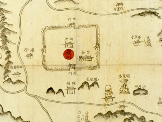
Gyeongju served as the capital of the Silla kingdom for almost a millennium and reached its height under Unified Silla, from the late seventh to the ninth centuries. The city was laid out on a north-south grid of residential wards (bang) modelled on the Chinese capital tradition, organising palaces, government offices, markets and dwellings within a regular street pattern set in a basin among low hills. Royal tumuli, fortresses and Buddhist temple precincts were woven through and around the urban fabric, while monuments such as Bulguksa temple and Seokguram grotto on the city's fringes expressed the close integration of political power, religion and planned settlement.
Significance
Gyeongju is the pre-eminent surviving example of a Korean royal capital shaped by imported East Asian planning ideas, demonstrating how the gridded ward model was adapted to a distinct topography and Buddhist culture. Its concentration of palaces, tombs, temples and astronomical and devotional monuments, recognised as a UNESCO World Heritage site, makes it a key reference for the transmission of capital-city planning across East Asia.
What shaped it
- The walled-ward (fang) city system (Sui–Tang, c. 6th–9th c.)
- Buddhism (c. 5th c. BCE)
- Tang–Song examination bureaucracy (605–960s)