Honolulu Oahu General Plan / TOD
Core idea
Rail TOD + climate adaptation
Why it matters
Island metropolis growth without sprawl
Description
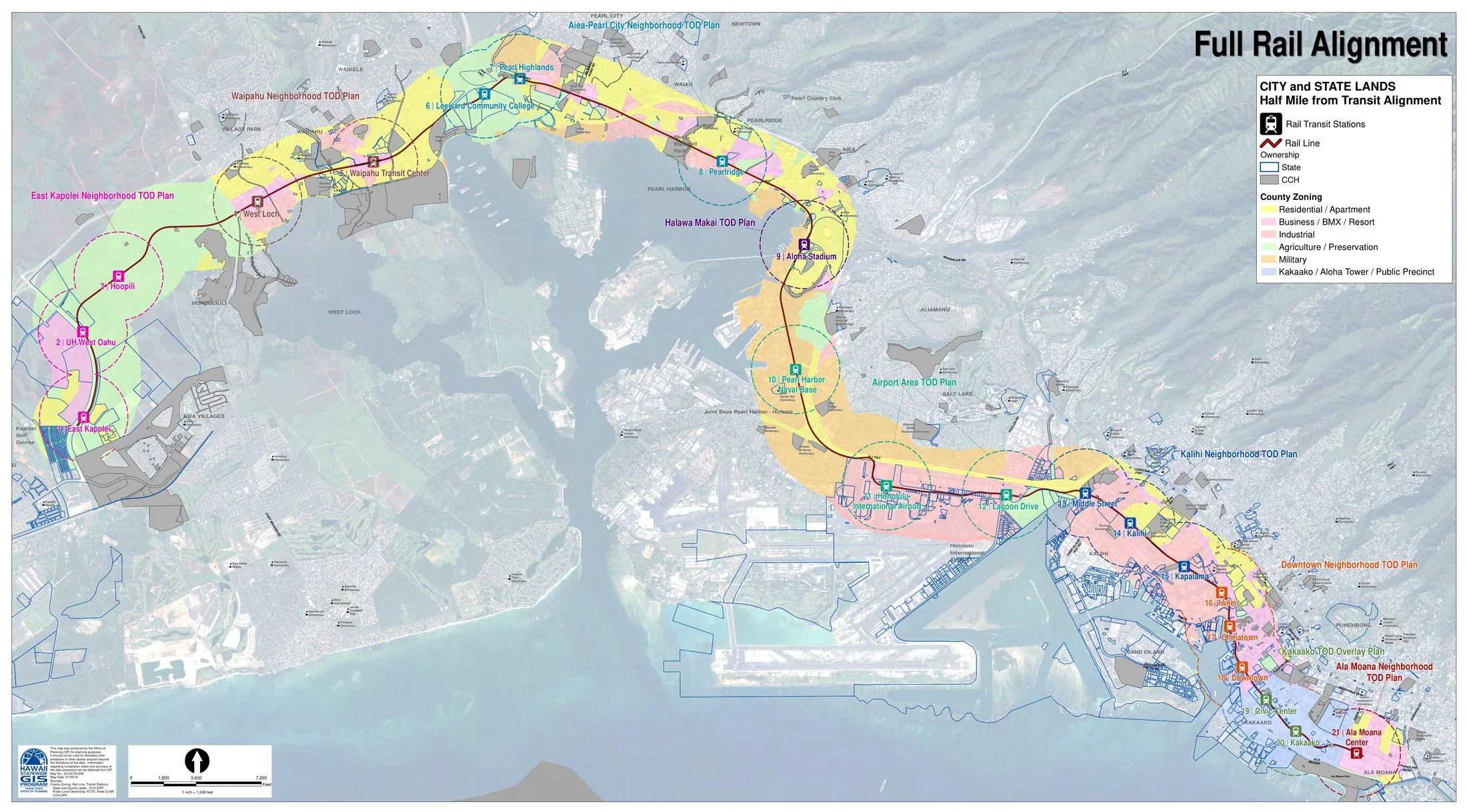
Honolulu's planning framework of the 2010s pairs the updated Oahu General Plan with a programme of transit-oriented development plans along the elevated rail line then under construction across the island's southern shore. Prepared by the City and County of Honolulu, the neighbourhood TOD plans, advanced from the mid-2010s, concentrate mixed-use growth, affordable housing and public-realm improvements around stations from East Kapolei towards downtown, while the general plan directs growth away from agricultural and conservation lands. Climate adaptation and sea-level rise figure explicitly in the corridor planning.
Significance
The programme represents an island metropolis attempting to absorb growth without sprawl, using one of the most expensive transit projects in the United States as its spatial spine. It is significant for coupling TOD with Hawaii's acute housing-affordability problem and with coastal climate vulnerability, and the rail project's delays and costs have kept the strategy politically contested. It extends the American TOD tradition into a distinctive insular and Pacific context.
What shaped it
- Transit-oriented development (TOD) (1993)
- The Transit Metropolis (Cervero) (1998)
- Urban resilience (2013)
Sources
- https://www.hawaiipublicradio.org/local-news/2021-11-19/oahu-general-plan-could-soon-be-updated-
- https://www.honolulu.gov/tod/tod-planning-initiatives/