Kaesong (Goryeo Capital)
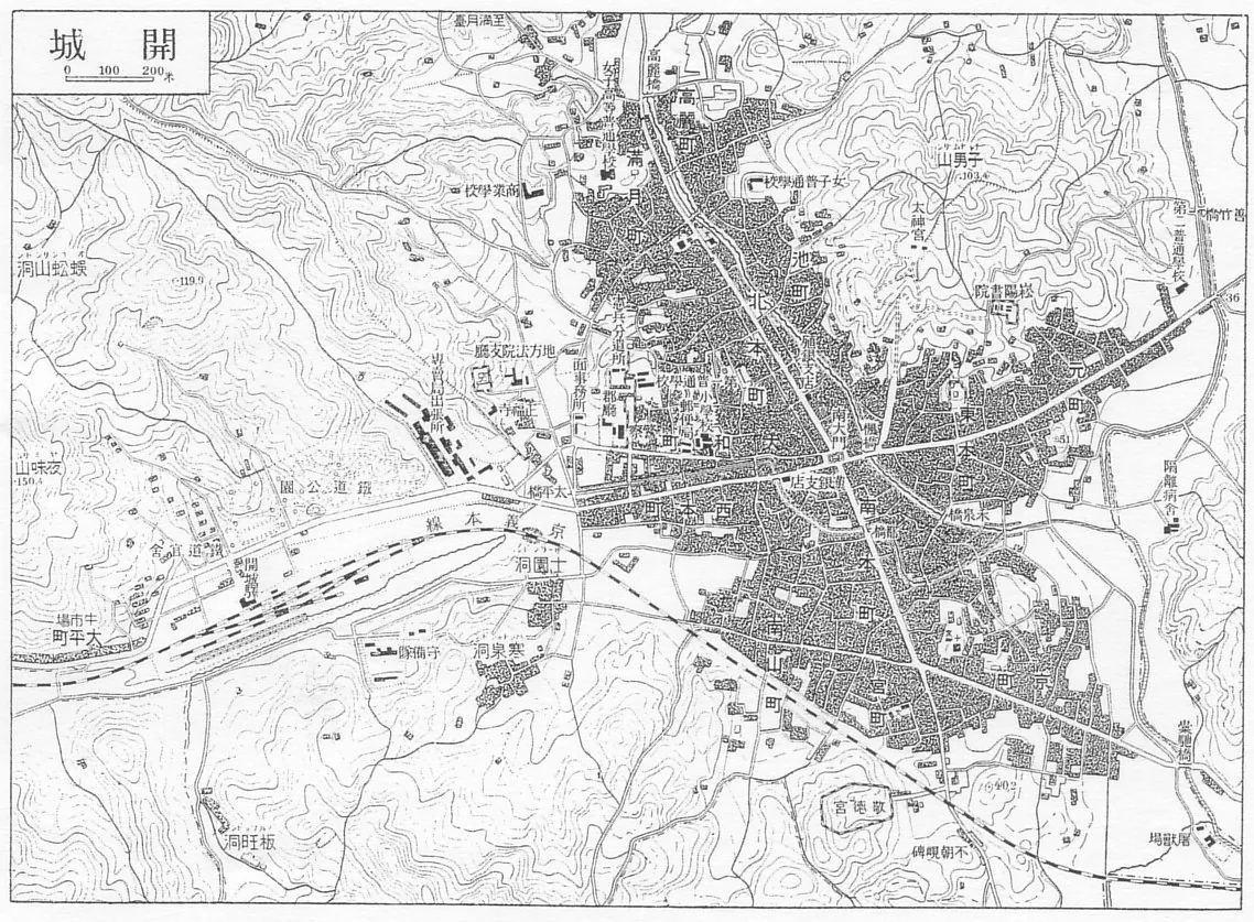
Core idea
Geomantically planned Goryeo capital in a mountain-ringed basin, with walls linking the surrounding peaks
Why it matters
A leading example of geomancy-driven Korean capital planning, recognised as a UNESCO World Heritage Site
Description
In 919 Wang Geon, founder of Goryeo, made his native Songak, modern Kaesong, the dynasty's capital, siting it according to pungsu geomantic principles within a basin ringed by mountains. The Manwoldae royal palace stood at the foot of Mount Songak, and the city was enclosed by multiple defensive walls, an inner palace wall and outer ramparts that linked the surrounding peaks into a continuous defensive ring. The wider complex of palaces, walls, gates, tombs, schools and an astronomical observatory was inscribed by UNESCO in 2013 as the Historic Monuments and Sites in Kaesong, recognising it as the embodiment of Goryeo political, cultural and geomantic urban tradition.
Significance
Kaesong was the capital of unified Goryeo for some four and a half centuries and is a leading example of geomancy-driven Korean capital planning, in which the city's form follows the surrounding topography rather than a rigid imported grid. Its walls linking the encircling peaks and its pungsu siting mark a distinct East Asian tradition of landscape-led urbanism, now a UNESCO World Heritage Site.
What became of it
Served as Goryeo's capital 919-1392; demoted after the Joseon move to Hanseong (Seoul), it survived as a regional town and its walls, palace site (Manwoldae) and tombs are now a UNESCO World Heritage ensemble.
Critique
Scholarship emphasises that the layout was dictated by pungsu (geomancy) and rugged topography rather than an orthogonal grid, complicating comparisons with Chinese-style capitals.
What shaped it
- Fengshui landscape cosmology (Han onward, codified by Song)
- The walled-ward (fang) city system (Sui–Tang, c. 6th–9th c.)
- Buddhism (c. 5th c. BCE)
- The grid (c. 2500 BCE)