Lisbon Alcântara Waterfront Plan
Core idea
Port–city interface redevelopment
Why it matters
Extends Lisbon’s riverfront transformation
Description
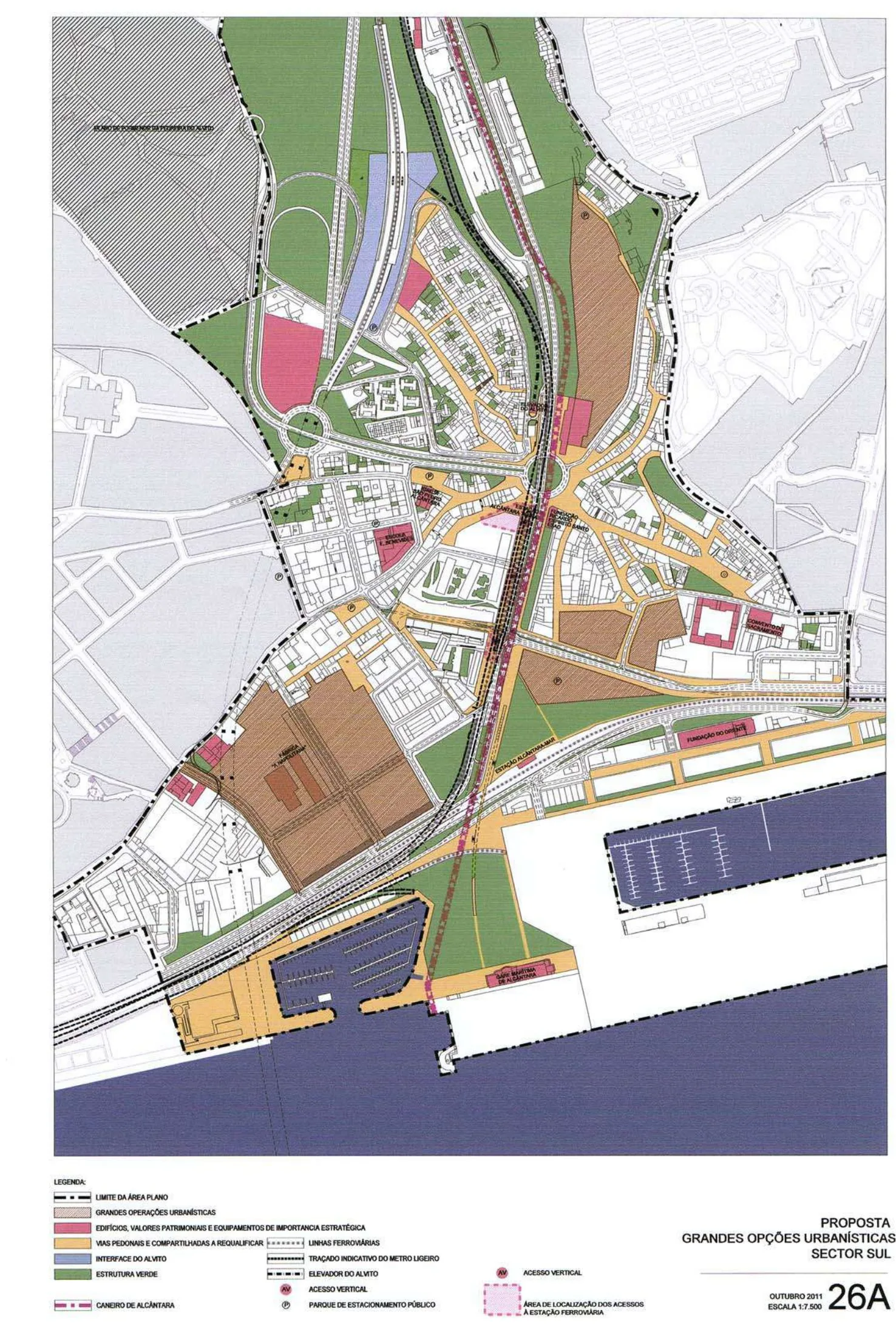
The Alcântara waterfront plan of 2008 addresses the port–city interface in western Lisbon, where docklands, rail infrastructure and industrial parcels separate the Alcântara district from the Tagus. Prepared through the municipality and the Port of Lisbon authority, it proposes the redevelopment and reuse of port-adjacent land, improved connections between neighbourhood and river, and mixed-use regeneration continuing the transformation of Lisbon's riverfront begun in the 1990s.
Significance
The plan belongs to the wider European movement of post-industrial waterfront regeneration, extending Lisbon's riverfront renewal—initiated at the Expo '98 site—towards the working port areas of the west. It is significant for negotiating the coexistence of an active port with urban regeneration, a recurring tension in port-city planning, and for consolidating the Tagus frontage as the organising element of contemporary Lisbon planning.
What shaped it
- The diesel ship and the modern port (diesel ships from 1912; container shipping 1956)
- World becomes majority urban (2007)
- Global financial crisis (2007–2009)
- Landscape urbanism (Waldheim) (1997-2006)
Sources
- https://www.lisboa.pt/temas/urbanismo/planeamento-urbano/plano-geral-de-intervencoes-da-frente-r
- https://www.publico.pt/2008/03/28/local/noticia/lisboa-primeira-parte-do-plano-urbanizacao-da-zo