Mexico City Plan Director
Core idea
Urban structure & arterials
Why it matters
First metropolitan-scale framework
Description
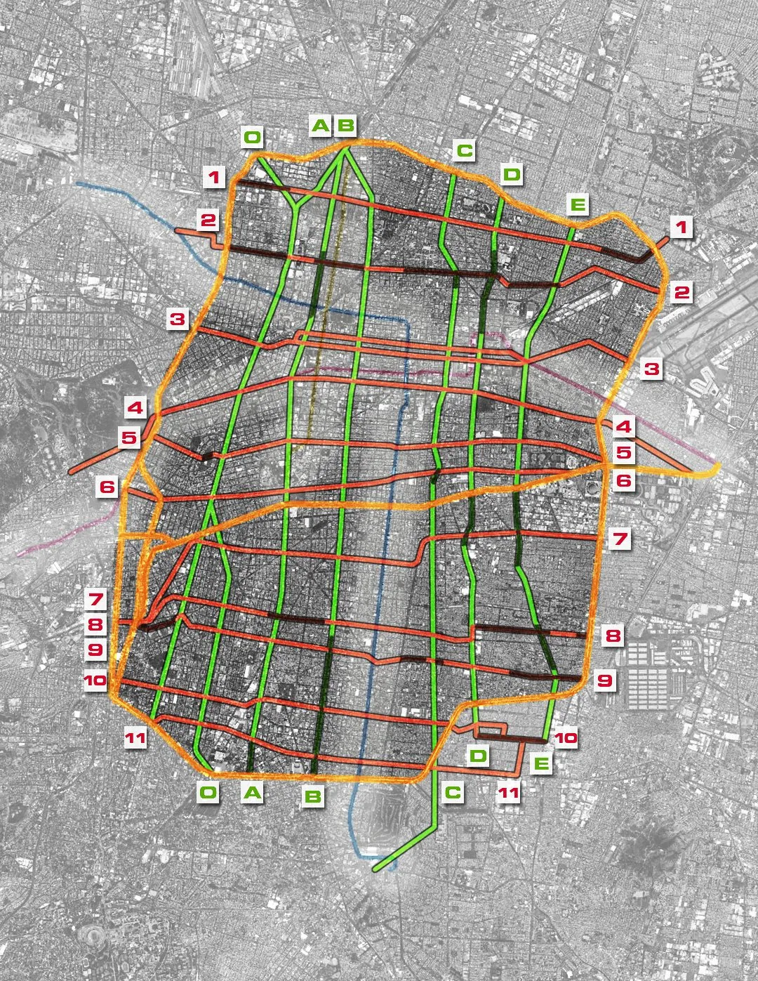
The 1976 Plan Director for the Federal District of Mexico City, prepared under the Departamento del Distrito Federal, was the first comprehensive planning framework to address the capital at something approaching metropolitan scale. It set out an intended urban structure of centres and land-use zones organised around a hierarchy of arterial roads, including the ejes viales system of one-way arterials that restructured circulation across the city. The plan sought to bring order to explosive growth in one of the world's fastest-expanding metropolises.
Significance
As the first metropolitan-scale framework for Mexico City, the plan marks the moment when Latin America's largest urban agglomeration acquired a formal planning instrument, and its arterial logic still structures movement in the capital. It is also emblematic of the limits of master planning in rapidly urbanising contexts, since informal expansion beyond the Federal District's boundaries continued largely outside its reach, fuelling later debates on metropolitan governance.
What shaped it
- The master plan (early 20th c.)
- The urban freeway (mid-20th c.)
- UN Habitat I (1976)
- Zoning (1884 Germany / 1916 NYC)
Sources
- https://www.dof.gob.mx/nota_detalle.php?codigo=4856695&fecha=30/11/1976
- https://www.scielo.org.mx/scielo.php?script=sci_arttext&pid=S0188-46112009000200016