Montréal PMAD
Core idea
Transit-oriented regional development
Why it matters
Aligns municipalities around metro growth
Description
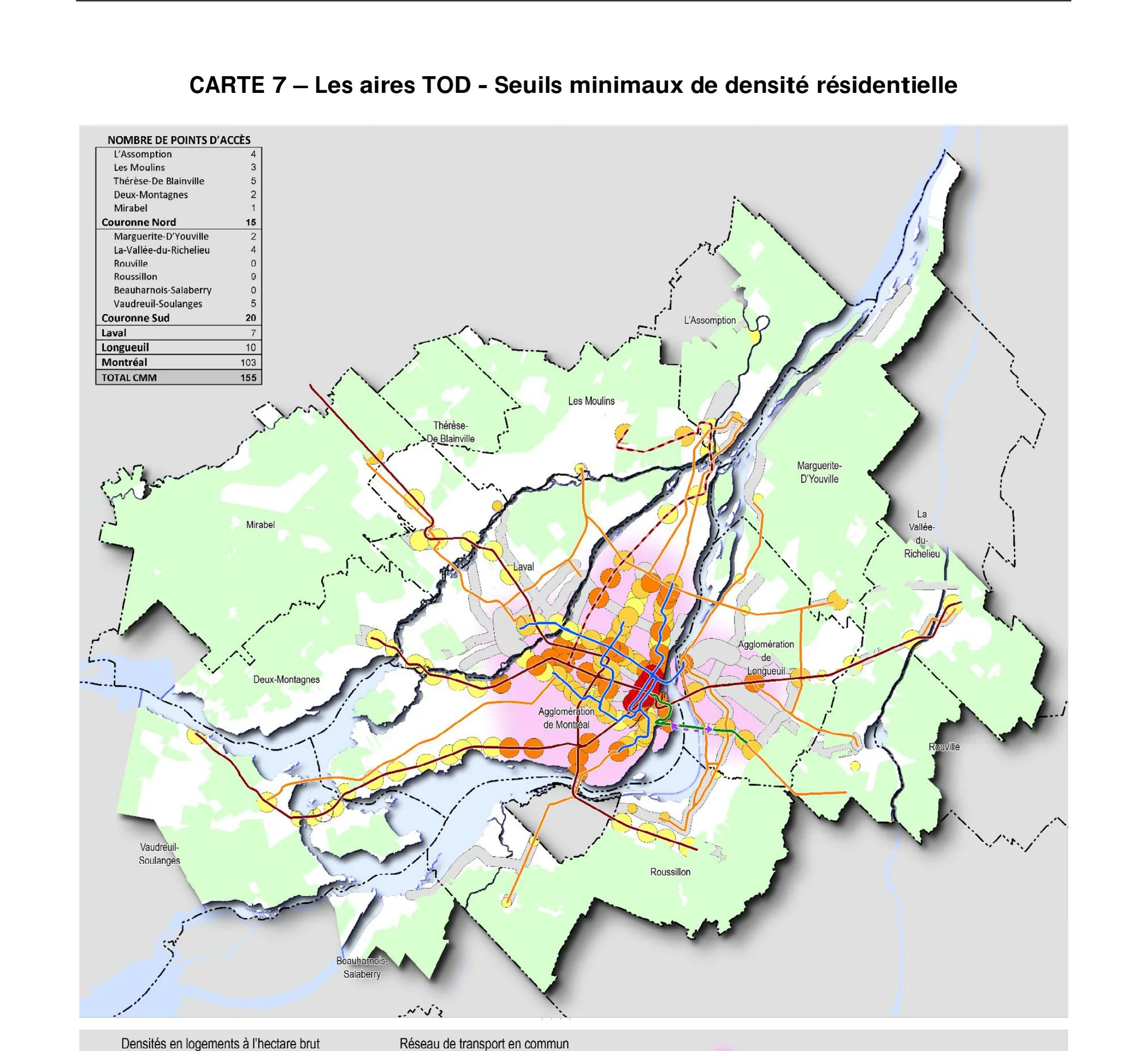
The Plan métropolitain d'aménagement et de développement, adopted in 2012 by the Communauté métropolitaine de Montréal, the regional body covering the greater Montréal area and its dozens of municipalities. The plan sets a transit-oriented development strategy, directing a large share of new households to areas around metro, commuter rail and busway stations, while fixing densification thresholds and protecting agricultural and natural land at the metropolitan edge. It binds local plans to a common regional framework.
Significance
The PMAD marked a step change in Canadian metropolitan planning by aligning many independent municipalities behind measurable TOD and containment targets. It is frequently compared with Vancouver's and Toronto's regional frameworks in debates on how to govern growth across fragmented metropolitan areas, and it has shaped subsequent transit investment and station-area planning in the Montréal region.
What shaped it
- Transit-oriented development (TOD) (1993)
- The compact city (1973-1990s)
- The Just City (Fainstein) (2010)
- The green belt (1898 concept / 1938 law)
Sources
- https://cmm.qc.ca/planification/plan-metropolitain-damenagement-et-de-developpement-pmad/
- https://www.mamh.gouv.qc.ca/amenagement-du-territoire/guide-la-prise-de-decision-en-urbanisme/pl