Mysore (Mysuru)
Core idea
Royal capital progressively replanned with boulevards, drainage, water supply and planned extensions
Why it matters
An early Indian princely-state model of organised, sanitary civic development
Description
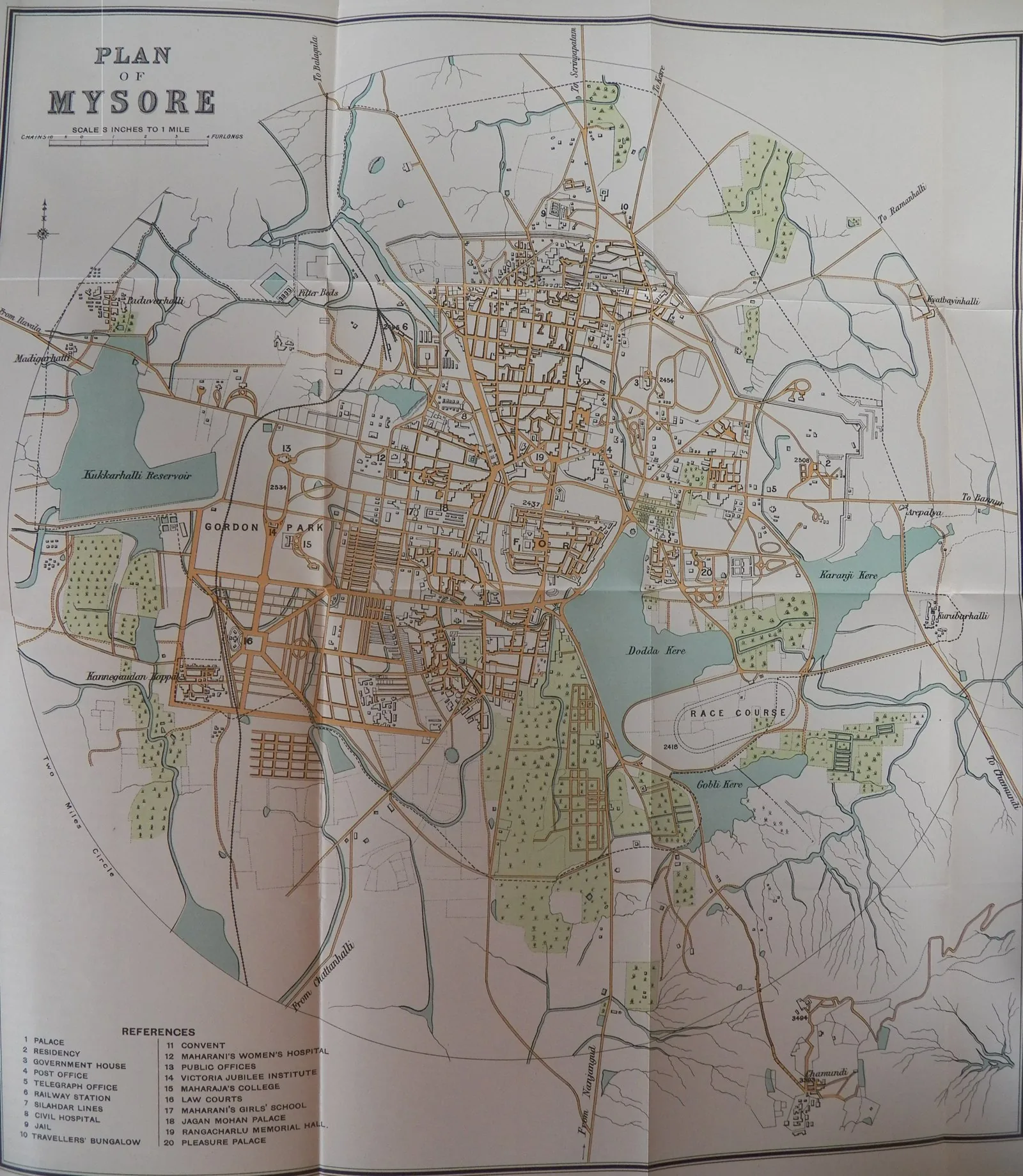
When the Wodeyar dynasty was restored to Mysore in 1799 after the fall of Tipu Sultan, the city resumed its role as the kingdom's capital and, especially from the late nineteenth century, became a showcase of princely-state planning. A municipal statute of 1888, decongestion of the fort and the conversion of filled ditches into roads and parks were followed under chief engineer and dewan Sir M. Visvesvaraya by an early underground sewerage and drainage system, completed across the city by about 1910, and a piped water supply. Dewan Mirza Ismail added wide boulevards, gardens, civic buildings and planned residential extensions, giving Mysore an ordered, green and sanitary fabric.
Significance
Mysore is among India's earliest examples of systematic, state-led urban planning, undertaken by a princely government rather than the colonial authorities. The drainage, water supply, boulevards and planned extensions delivered under Visvesvaraya and Mirza Ismail anticipated municipal reforms elsewhere in the subcontinent and produced one of India's most consciously ordered and 'garden' cities, a model of monarchical modernisation in the half-century before independence.
What shaped it
- The British Empire and modern colonialism (1600 – 20th c.)
Plans it influenced
- Paris Transformations (Haussmann) (1853–1870)
Sources
- https://www.cambridge.org/core/journals/urban-history/article/abs/monarchical-modern-the-making-
- https://en.wikipedia.org/wiki/Mysore