Nairobi Integrated Urban Dev. Master Plan (NIUPLAN)
Core idea
Transport, utilities, land-use integration
Why it matters
Update to manage explosive growth
Description
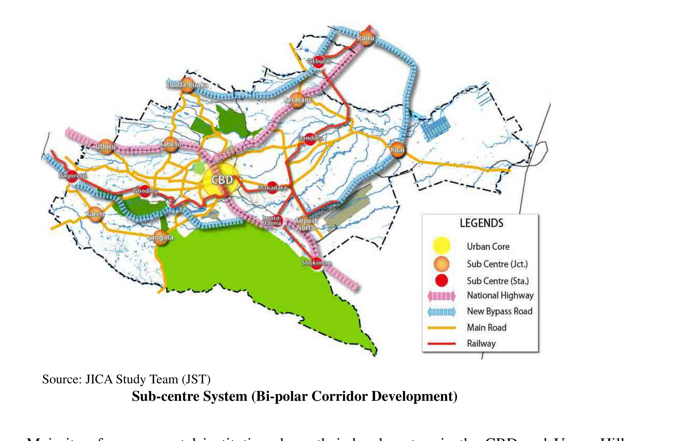
The Nairobi Integrated Urban Development Master Plan (NIUPLAN), completed in 2014 by the Nairobi city government with technical assistance from the Japan International Cooperation Agency, is a comprehensive master plan for the Kenyan capital with a horizon around 2030. It integrates land use, transport, water, sewerage and other utilities within a single spatial framework, proposing a hierarchy of subcentres, major road and rail corridor improvements and coordinated infrastructure investment to manage rapid population growth.
Significance
NIUPLAN was Nairobi's first full master plan update since the 1973 metropolitan growth strategy, and it exemplifies the donor-supported comprehensive planning that has shaped many African capitals confronting explosive informal growth. Its significance is debated: it provides an integrating reference for investment, yet critics question the capacity of formal master planning to steer a city where most development occurs outside regulatory channels.
What shaped it
- The master plan (early 20th c.)
- Zoning (1884 Germany / 1916 NYC)
- Bus Rapid Transit (BRT) (1974)
Sources
- https://openjicareport.jica.go.jp/pdf/12184040.pdf
- https://www.constructionkenya.com/2212/nairobi-city-masterplan/