Nantes Île de Nantes Mobility & Land Use
Core idea
Tram/busways + phased build-out
Why it matters
Process-led island urbanism
Description
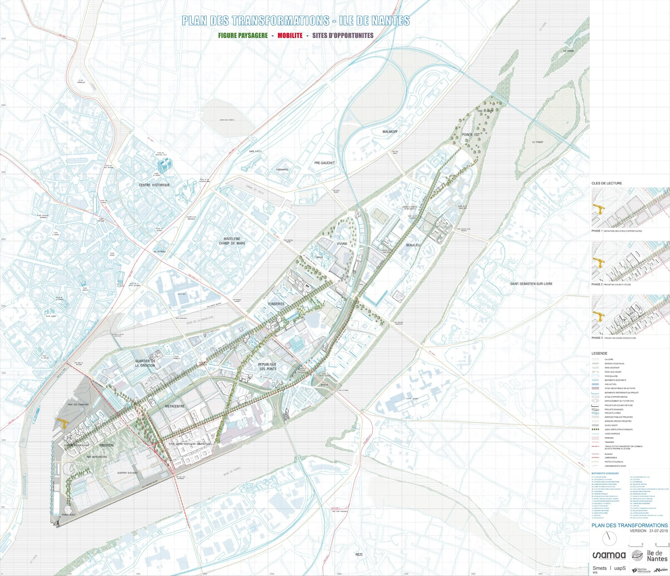
The Île de Nantes mobility and land-use planning of the 2010s continued the transformation of the large Loire island opposite central Nantes, coordinated by SAMOA, the public development corporation. Building on the earlier plan-guide method of Alexandre Chemetoff and successors including uapS, it phased new tram and busway connections, bridges and street networks alongside incremental redevelopment of former shipyard and industrial land for housing, the university hospital and creative-industry uses.
Significance
Île de Nantes is internationally influential as an exemplar of process-led urbanism, in which an evolving plan-guide and a dedicated public agency steer transformation over decades rather than fixing a masterplan at the outset. The integration of transit phasing with land release is widely studied, and the project contributed to Nantes' reputation in European urbanism, including its 2013 European Green Capital title. It features prominently in debates on adaptive planning methods.
What shaped it
- Transit-oriented development (TOD) (1993)
- Bus Rapid Transit (BRT) (1974)
- Landscape urbanism (Waldheim) (1997-2006)
Sources
- https://www.samoa-nantes.fr/pole-urbain/les-grandes-lignes-du-projet/
- https://urbanmaestro.org/wp-content/uploads/2020/09/urban-maestro_samoa-ile-de-nantes_h-morteau.