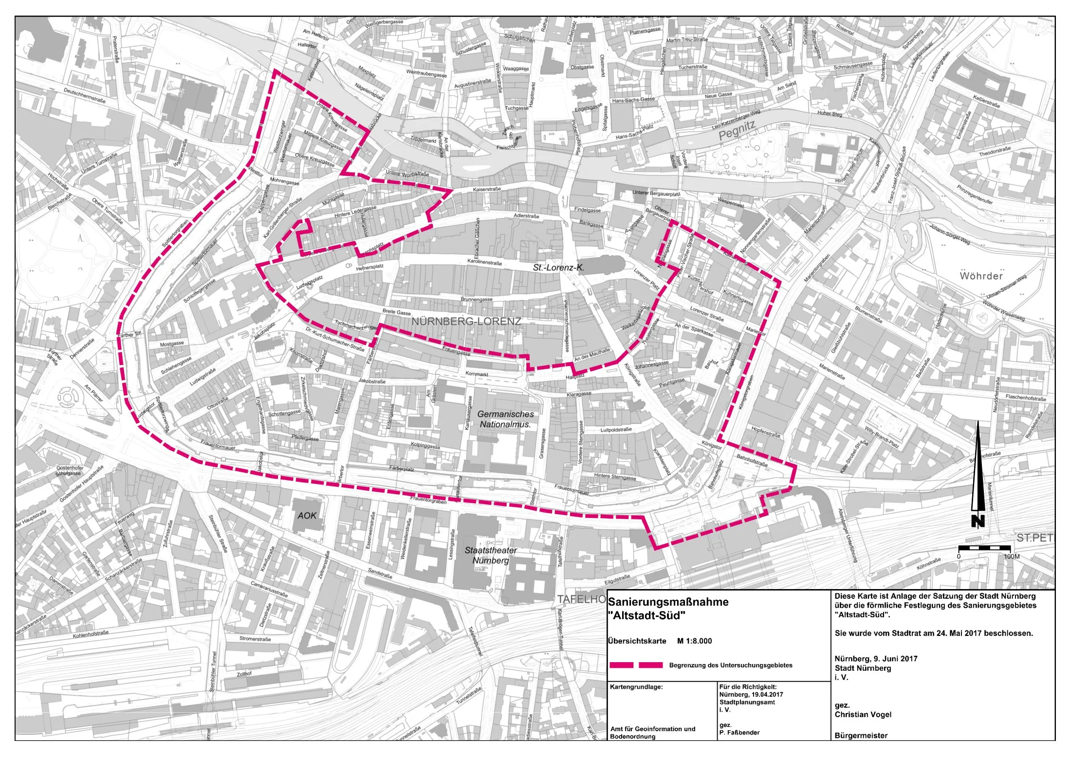
Nuremberg Südöstliche Altstadt Plan
Core idea
Public realm & infill in historic core
Why it matters
Heritage-compatible densification
Description
The Nuremberg Südöstliche Altstadt plan, prepared by the city in the 2010s, guides the careful renewal of the south-eastern quarter of the historic old town. It concentrates on upgrading streets and public spaces, repairing the urban fabric with infill housing and mixed uses on underused plots, and strengthening everyday functions within the post-war reconstructed core, in a manner calibrated to the district's heritage character.
Significance
The plan exemplifies the German tradition of behutsame Stadterneuerung, or careful urban renewal, applied to a city whose old town was rebuilt after wartime destruction. Its significance lies in demonstrating heritage-compatible densification: adding homes and activity within a historic core without resorting to large-scale clearance, a model increasingly relevant as European cities seek growth inside existing footprints.
What shaped it
- City Planning According to Artistic Principles (1889)
- The pedestrian zone (1953)
- The compact city (1973-1990s)
- Global financial crisis (2007–2009)
Sources
- https://www.nuernberg.de/internet/stadtplanung/altstadtsued.html
- https://www.nuernberg.de/internet/stadtplanung/stadtteilkonzepte_stpl.html