Orlando SunRail Station Area Plans
Core idea
TOD around commuter rail
Why it matters
Emergent Central Florida urbanism
Description
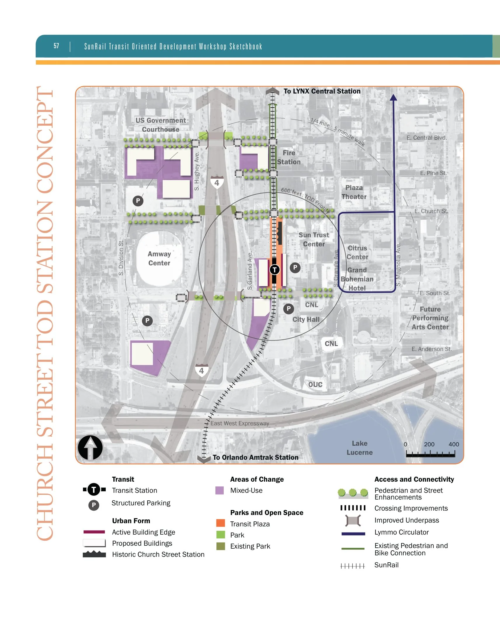
A family of station area plans prepared under the auspices of MetroPlan Orlando, the metropolitan planning organisation for Central Florida, following the opening of the SunRail commuter rail line in the 2010s. The plans designate transit-oriented development zones around stations along the north–south corridor through Orlando and its neighbouring counties, encouraging mixed-use infill, higher densities and walkable street networks in place of car-dependent suburban patterns. Individual municipalities have translated the framework into zoning overlays and streetscape investments around their stations.
Significance
The plans mark an attempt to retrofit transit-oriented urbanism onto one of the most sprawl-dominated metropolitan regions in the United States. They illustrate how a commuter rail investment can be used as a lever for corridor-scale land use change, and they form part of a wider Sun Belt debate about whether rail-led densification can take hold in regions built almost entirely around the motor car.
What shaped it
- Transit-oriented development (TOD) (1993)
- The compact city (1973-1990s)
- Global financial crisis (2007–2009)
Sources
- https://metroplanorlando.gov/wp-content/uploads/SunRail-TOD-Report-November-2018.pdf
- https://metroplanorlando.gov/partner/sunrail/