Paris Rive Gauche (PRG) – 13e Arrondissement
Core idea
Decking rail yards and creating mixed-use neighborhoods
Why it matters
Reconnected Left Bank with new urban quarter and universities
Description
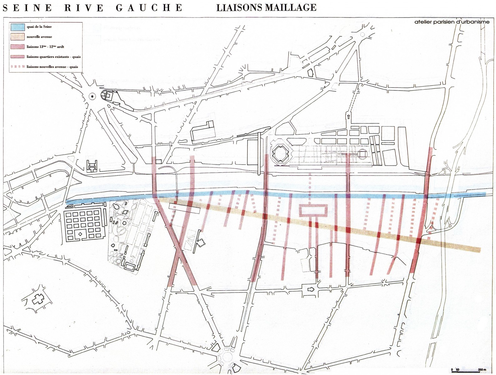
Paris Rive Gauche is a large urban development zone (ZAC) launched in 1991 along the Seine in the 13th arrondissement, led by the development company SEMAPA with planning input from the Atelier Parisien d'Urbanisme. Its defining move was to deck over the rail yards leading into the Gare d'Austerlitz, creating a new ground plane on which mixed-use neighbourhoods, offices, housing and the Bibliothèque nationale de France were built. The operation covers around 130 hectares and was organised into sectors, each entrusted to different coordinating architects, with universities later anchoring the Masséna quarter.
Significance
The project became a European reference for reclaiming railway land in the heart of a dense capital and for reconnecting a city to its river. Its sectoral approach, with plural architectural authorship inside a strong public framework, was influential as an alternative to single-master-plan megaprojects. It also fuelled debates in France about the balance between office-led development and housing, and about participation, after early criticism prompted revisions towards more mixed and university-oriented programmes.
What shaped it
- Land-value capture and betterment (developed from the early 20th century)
- Transit-oriented development (TOD) (1993)
- The compact city (1973-1990s)
Plans it influenced
- Marseille Euroméditerranée (1995–)
- Clichy–Batignolles (Parc Martin Luther King) (2002)
- Île de Nantes (2000–)
Sources
- https://en.wikipedia.org/wiki/Paris_Rive_Gauche
- https://www.c40.org/case-studies/c40-good-practice-guides-paris-quartier-massena-rive-gauche/