Plaça de les Glòries Catalanes Redevelopment
Core idea
Removing ring junction; creating park and cultural hub
Why it matters
Corrects a long-standing traffic nexus
Description
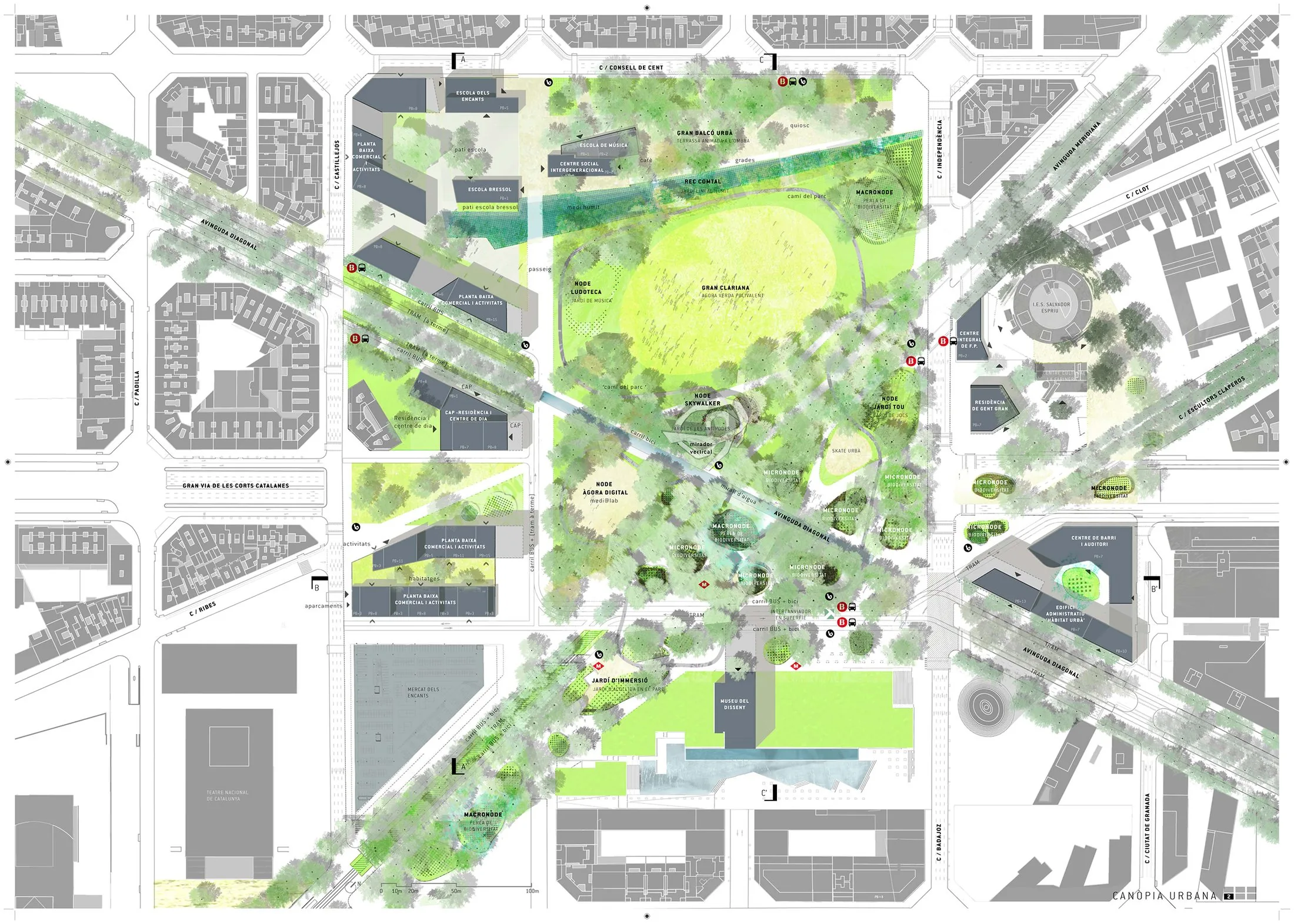
A municipal redevelopment project by the Ajuntament de Barcelona to dismantle the elevated ring-road interchange at Plaça de les Glòries Catalanes, the junction Cerdà had once envisaged as the true centre of his Eixample. Through-traffic on the Gran Via was placed in tunnels and the freed surface converted into a large public park, the Canòpia, designed following an international competition, alongside cultural facilities such as the Disseny Hub and the rebuilt Encants market. The scheme, launched in 2013, transforms a district-scale traffic node into a green civic space linking surrounding neighbourhoods.
Significance
Glòries is among the most prominent European examples of motorway infrastructure removal within a dense city, correcting a 1960s–90s traffic solution that had long severed the eastern Eixample. It sits within Barcelona's broader tradition of public-space-led urbanism and is regularly invoked in debates on highway-to-park conversion, traffic evaporation and the reclamation of road space for climate adaptation.
What shaped it
- The public park (1843–1858)
- The pedestrian zone (1953)
- Landscape urbanism (Waldheim) (1997-2006)
Sources
- https://ajuntament.barcelona.cat/ecologiaurbana/en/bodies-involved/citizen-participation/les-glo
- https://www.metalocus.es/en/news/first-prize-remodelation-glorias-square-barcelona