Priene
Core idea
Terraced orthogonal plan
Why it matters
Adapts the grid to steep topography
Description
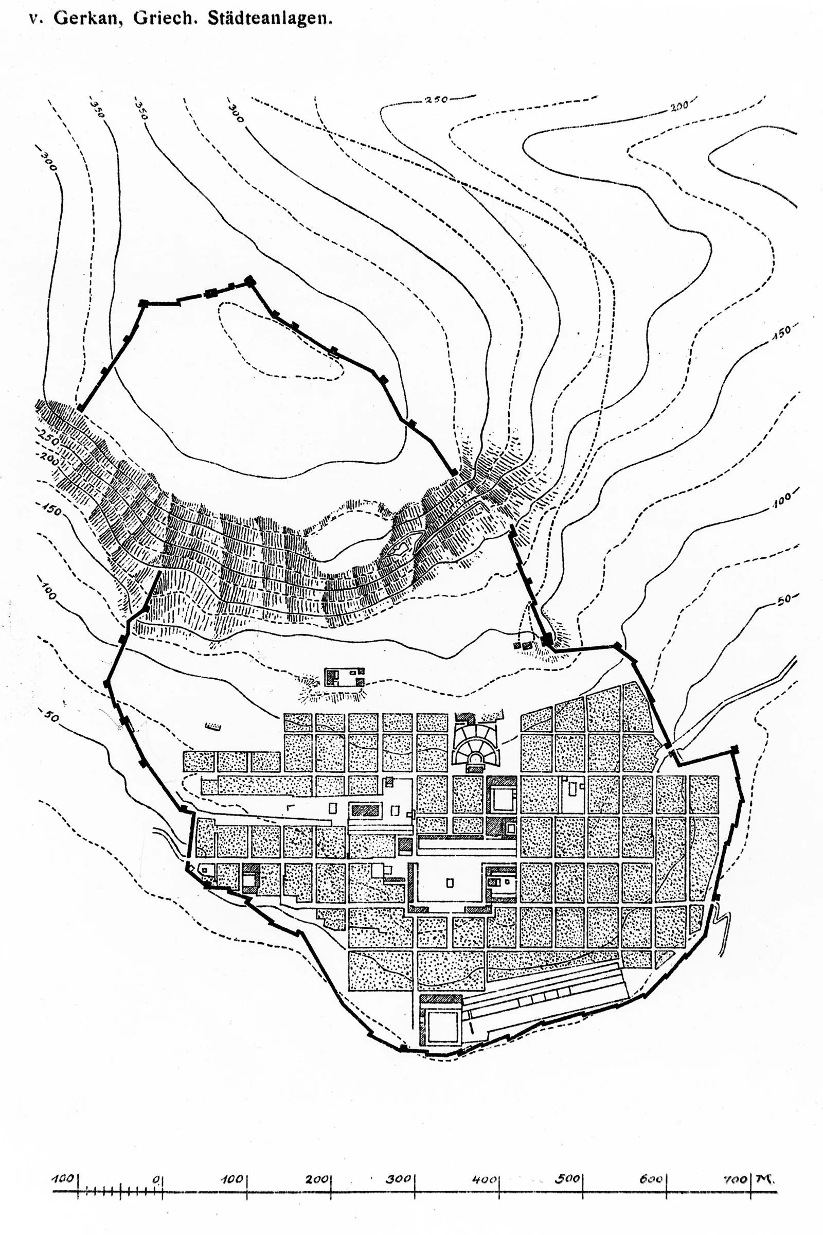
Priene, a Greek city in Ionia in present-day western Turkey, was rebuilt on a new site in the fourth century BCE following the Hippodamian tradition. Its planners imposed a strict orthogonal grid of uniform blocks on the steep southern slope of Mount Mycale, with east-west streets running along the contours as level terraces and north-south lanes climbing as stepped paths, while the agora, theatre and Temple of Athena occupied set positions within the frame.
Significance
Priene is the classic demonstration that the Greek grid was a flexible intellectual system rather than a formula for flat ground, since the plan adapts rigorous geometry to dramatic topography through terracing. Because the city was never substantially rebuilt, it survives as one of the most legible examples of Hellenistic town planning and has served generations of planners and historians as a textbook case.
What became of it
Laid out anew on a terraced Hippodamian grid in the mid-4th century BCE (associated with Mausolus/Alexander); occupied through the Hellenistic and Roman periods, then declined as its harbour silted and was abandoned, leaving it exceptionally well preserved.
Critique
Scholars note the rigid grid imposed on steep terrain is sometimes read as ideological (equal plots) rather than practical, and the equal-allotment interpretation is debated.
What shaped it
- The grid (c. 2500 BCE)
- Greek philosophy (5th–4th c. BCE)
- The plaza / forum / agora (c. 500 BCE)
- Aristotle's Politics (c. 335 BCE)
Plans it influenced
- Timgad (c. 100 CE)
Sources
- https://historygreek.org/settlements/priene
- https://www.livius.org/articles/concept/hippodamian-plan/