Riga Development Plan 2030
Core idea
Polycentric nodes along transit
Why it matters
Post-socialist metropolitan repositioning
Description
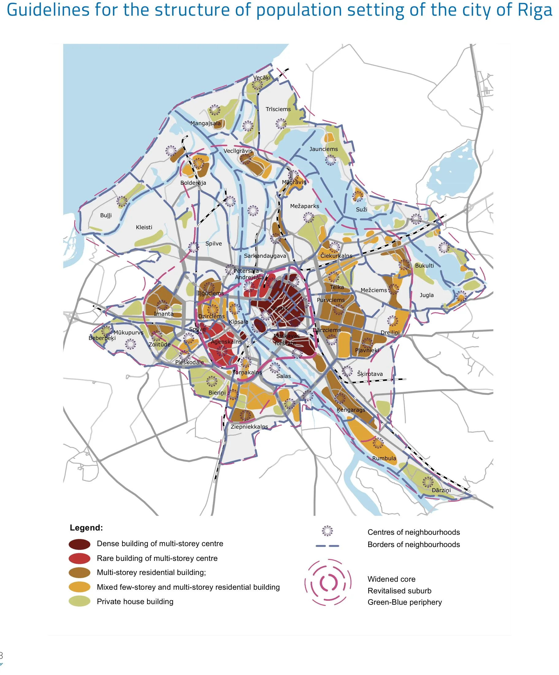
A long-range spatial development plan for the Latvian capital, prepared by Riga City Council and adopted in the mid-2010s with a horizon of 2030. It sought to restructure a shrinking, post-socialist metropolis around a network of polycentric nodes tied to public transport corridors, countering the sprawl and mono-centric pressure inherited from the Soviet period. The plan combined city-centre revitalisation, densification around transit, and coordination with the wider Riga metropolitan region.
Significance
The plan is representative of a wider Baltic and East-Central European effort to reposition post-socialist capitals through Western European planning instruments, notably polycentric structure and transit orientation. It illustrates how metropolitan regionalism was adapted to conditions of population decline rather than growth, a debate that distinguishes such plans from their booming Western counterparts.
What shaped it
- Transit-oriented development (TOD) (1993)
- The compact city (1973-1990s)
- The Leipzig Charter on Sustainable European Cities (2007 (renewed 2020))
- Urban resilience (2013)
Sources
- https://www.rdpad.lv/wp-content/uploads/2014/11/ENG_STRATEGIJA.pdf
- https://www.riga.lv/en/city-development-committee