San Francisco Transbay Redevelopment Plan
Core idea
HSR/Caltrain terminal district with towers and park
Why it matters
Station-district urbanism with land-value capture
Description
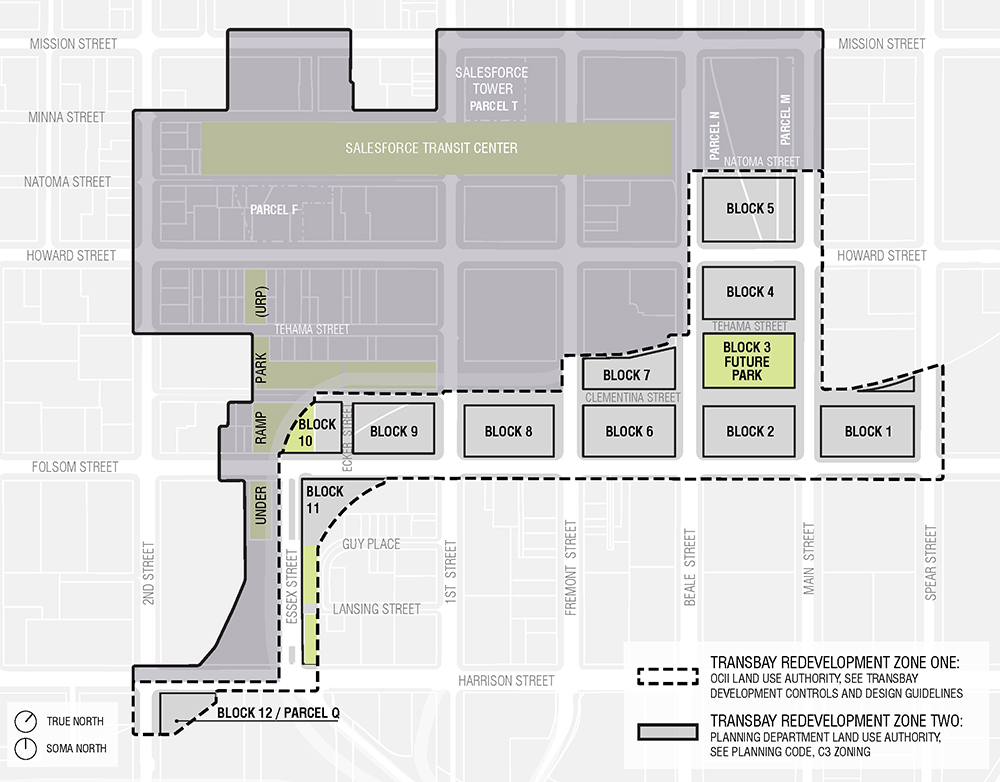
A redevelopment plan adopted in 2005 for the area around San Francisco's Transbay Terminal, prepared under what became the Office of Community Investment and Infrastructure with urban design by Skidmore, Owings & Merrill. The plan organised a high-density transit district around a rebuilt regional terminal intended to serve Caltrain and California high-speed rail, permitting a cluster of towers—including what became Salesforce Tower—alongside a rooftop park and a substantial share of affordable housing on former freeway parcels.
Significance
The Transbay plan is a leading American example of station-district planning financed through land-value capture, using the sale and taxation of publicly owned land to help fund the transit centre. It signalled a shift in San Francisco towards accepting significant height and density downtown, and it features in debates on tower clusters, value capture mechanics and the risks of tying urban districts to uncertain rail investment.
What shaped it
- Transit-oriented development (TOD) (1993)
- The Transit Metropolis (Cervero) (1998)
- The skyscraper (1885)
Plans it influenced
- Madrid Madrid Nuevo Norte (2019–)
Sources
- https://www.som.com/projects/transbay-design-for-development-plan/
- https://sfocii.org/projects/transbay/overview