San Francisco Treasure Island/Yerba Buena Master Plan
Core idea
Mixed-use eco-district on reclaimed naval base
Why it matters
Large bay island redevelopment
Description
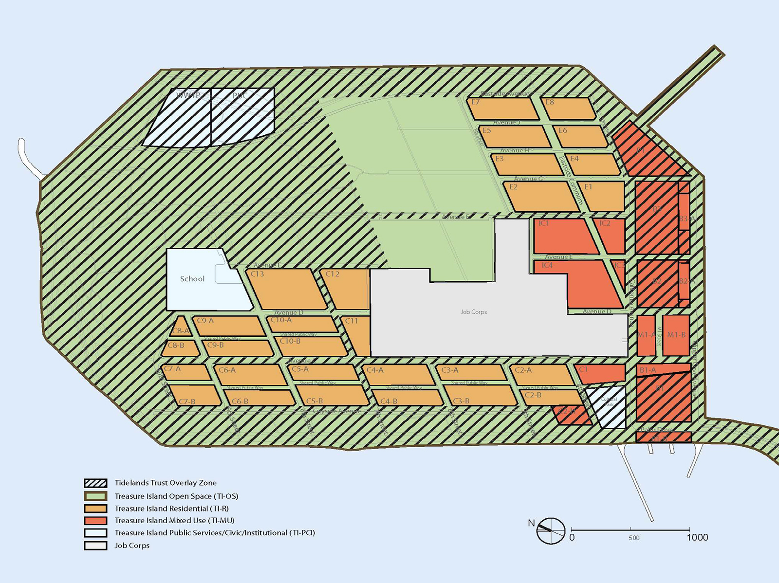
The Treasure Island and Yerba Buena Island master plan, approved by San Francisco in 2011, redevelops a former naval base on a man-made island in San Francisco Bay. Prepared by developers Wilson Meany and partners with Skidmore, Owings & Merrill as master planner, it concentrates a compact, walkable mixed-use district of housing and shops around a ferry terminal, leaving the greater part of the island as parks, urban agriculture and open space. The scheme incorporates measures for seismic ground improvement and adaptation to sea-level rise on low-lying reclaimed land.
Significance
The plan became a widely cited American example of eco-district thinking: transit-first design on an island with deliberately constrained car access, dense development clustered to free large areas for landscape. It is equally significant as a test case for building on vulnerable reclaimed land in an era of climate awareness, and its long remediation and phasing have fed debates on the feasibility of such conversions. It sits within the broader wave of military-base redevelopments that reshaped American waterfront cities after the Cold War.
What shaped it
- The compact city (1973-1990s)
- Transit-oriented development (TOD) (1993)
Sources
- https://www.som.com/projects/treasure-island-master-plan/
- https://sfplanning.org/project/treasure-island-yerba-buena-island