Seattle Waterfront Seattle Program
Core idea
Viaduct removal and new waterfront park
Why it matters
Global case of freeway removal + waterfront
Description
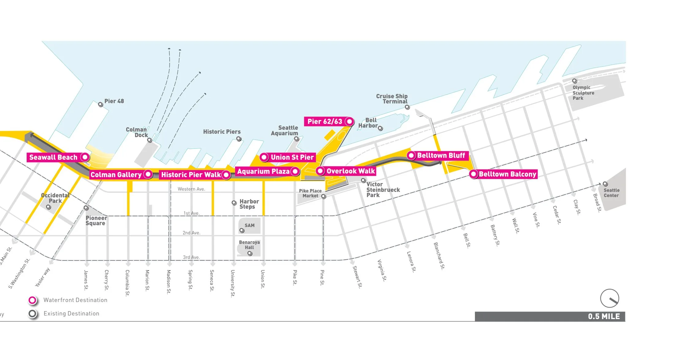
A public programme, initiated in 2012 by the City of Seattle with James Corner Field Operations as lead designer, to rebuild the central waterfront after the demolition of the elevated Alaskan Way Viaduct, whose traffic was rerouted into a bored highway tunnel. The plan creates a continuous park promenade along Elliott Bay, a rebuilt surface street, new east–west connections such as the Overlook Walk linking Pike Place Market to the water, and rehabilitated piers. The main elements were completed through the early 2020s.
Significance
Waterfront Seattle is one of the most cited contemporary cases of urban freeway removal, demonstrating that a downtown can trade an elevated highway for public space. It figures prominently in international debates on highway teardowns, seismic risk-driven infrastructure renewal and the design of post-industrial waterfronts, while also attracting scrutiny over the cost of the replacement tunnel.
What shaped it
- Landscape urbanism (Waldheim) (1997-2006)
- The urban freeway (mid-20th c.)
- The Death and Life of Great American Cities (1961)
- The public park (1843–1858)
- Urban resilience (2013)
Sources
- https://www.seattle.gov/waterfront/about-the-waterfront/program-overview
- https://world-architects.com/en/james-corner-field-operations-new-york/project/seattle-central-w