Somerville SomerVision
Core idea
Union Sq./GLX transit-led growth
Why it matters
Small city big upzoning exemplar
Description
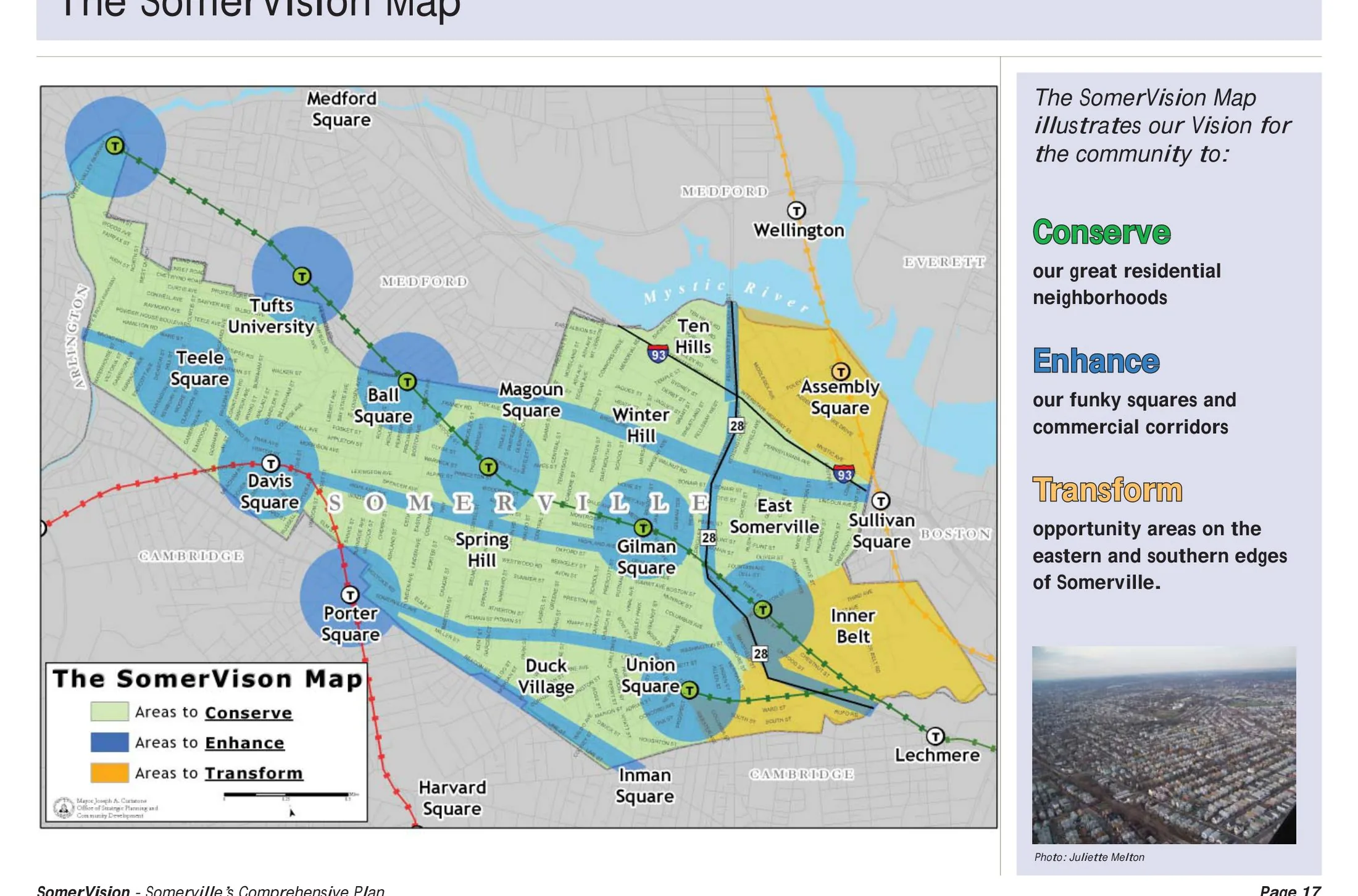
SomerVision, first adopted in 2012 and updated later in the decade, is the comprehensive plan of Somerville, Massachusetts, one of the most densely populated small cities in New England. Produced by the city with intensive civic participation, it channels growth into transformation areas around Union Square and the Green Line Extension light-rail corridor, setting numerical aspirations for new jobs, housing and open space while conserving established residential streets. It paired vision-setting with subsequent rezoning and station-area planning.
Significance
SomerVision is frequently cited as an exemplar of a small city leveraging a regional transit investment to pursue deliberate, large-scale upzoning and employment growth. Its clear quantitative targets and community-drafted narrative influenced comprehensive planning practice in the Boston region and beyond. The plan also frames ongoing debates in Somerville over displacement and affordability as transit arrival raised land values.
What shaped it
- Transit-oriented development (TOD) (1993)
- The Next American Metropolis / Charter of the New Urbanism (1993 / 1996)
- The compact city (1973-1990s)
- The metro / underground railway (1863)