Tucson Plan Tucson
Core idea
Corridor-focused mixed-use
Why it matters
Sun Belt reinvention around transit
Description
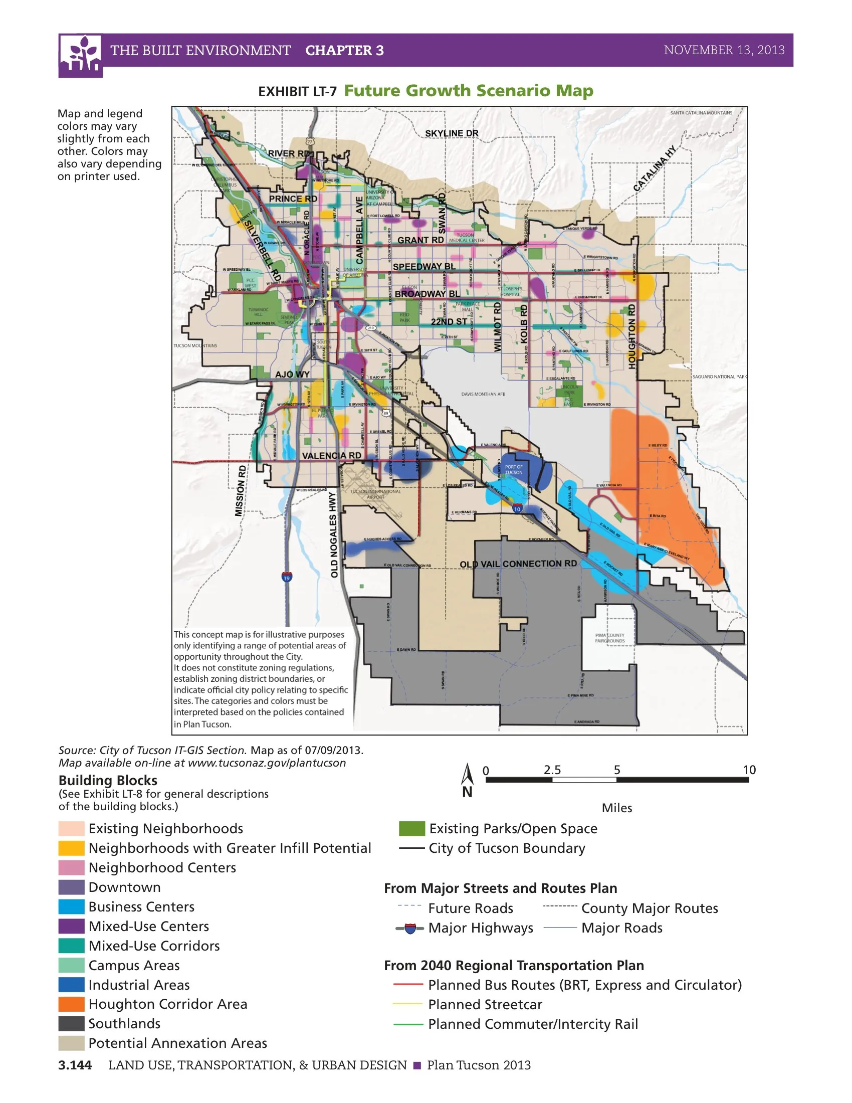
Plan Tucson, adopted by voters in 2013, is the general plan for the City of Tucson, Arizona, in the United States, prepared by the city as required under state law. It set a policy framework favouring infill and mixed-use development along key corridors rather than continued desert-edge expansion, supporting the Sun Link modern streetcar corridor between downtown and the university, alongside goals for water conservation, economic development and neighbourhood quality in an arid Sun Belt setting.
Significance
The plan represents the wider 2010s reorientation of Sun Belt cities from low-density growth towards corridor-focused reinvestment and transit-supportive infill. Coinciding with the 2014 opening of the streetcar and the revival of downtown Tucson, it illustrates how modest transit investment and plan-led corridor policy can redirect development in a car-oriented desert city. It is a useful representative case of comprehensive planning under Arizona's voter-ratification requirements.
What shaped it
- The compact city (1973-1990s)
- Transit-oriented development (TOD) (1993)
Sources
- https://ballotpedia.org/City_of_Tucson_%22Plan_Tucson%22_Ten_Year_General_Plan,_Proposition_402_
- https://www.tucsonaz.gov/files/sharedassets/public/v/1/pdsd/documents/plan-tucson-2013/chapter4-