Addis Ababa Structure Plan 2017–2027
Core idea
Transit corridors, TOD, ring roads
Why it matters
Guides one of Africa’s fastest-growing cities
Description
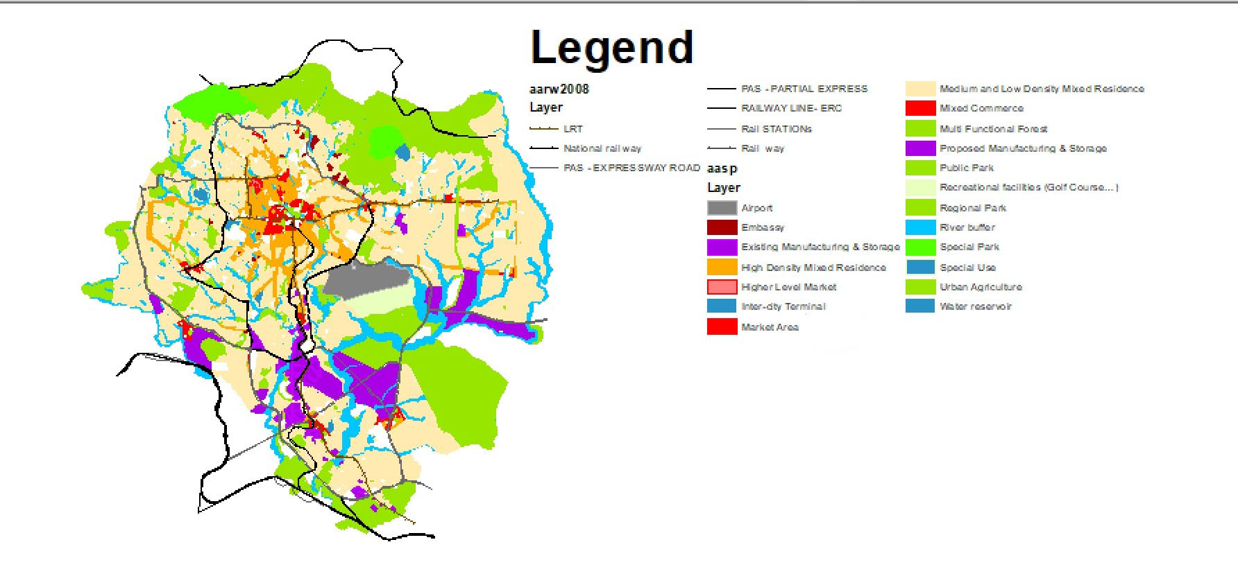
Addis Ababa's Structure Plan 2017–2027 sets a framework to guide the explosive growth of the Ethiopian capital and African Union seat, with a polycentric structure, transit corridors (including a new light rail), densification, and green space.
Significance
The Addis structure plan is a significant example of metropolitan planning in fast-urbanizing Africa, attempting to bring strategic order, transit, and density to one of the continent's key political capitals.
What became of it
The structure plan was enacted by Proclamation No. 49/2017 and adopted by the Addis Ababa City Council in July 2017, becoming the city's statutory ten-year framework guiding transit corridors, transit-oriented development and ring roads. Implementation has been partial, with the light rail and ring-road network advancing while large-scale housing and corridor targets have lagged amid rapid, often informal, growth.
Critique
Critics note the plan's ambitious housing and density targets sit uneasily against weak implementation capacity and continued displacement of low-income and peri-urban residents.
What shaped it
- Transit-oriented development (TOD) (1993)
- Bus Rapid Transit (BRT) (1974)
- The master plan (early 20th c.)
- SDG 11 — Sustainable Cities (2015)
- Planetary urbanisation (Brenner & Schmid) (2011-2014)
Plans it influenced
Sources
- https://ubwp.buffalo.edu/foodlab/wp-content/uploads/sites/68/2020/04/Addis-Ababa-City-Structure-
- https://www.scribd.com/document/405169240/2036-Addis-Ababa-Structural-Plan-2017-to-2027-original