Adelaide Riverbank Precinct Plan
Core idea
Cultural/sports riverfront integration
Why it matters
Unified river spine for city identity
Description
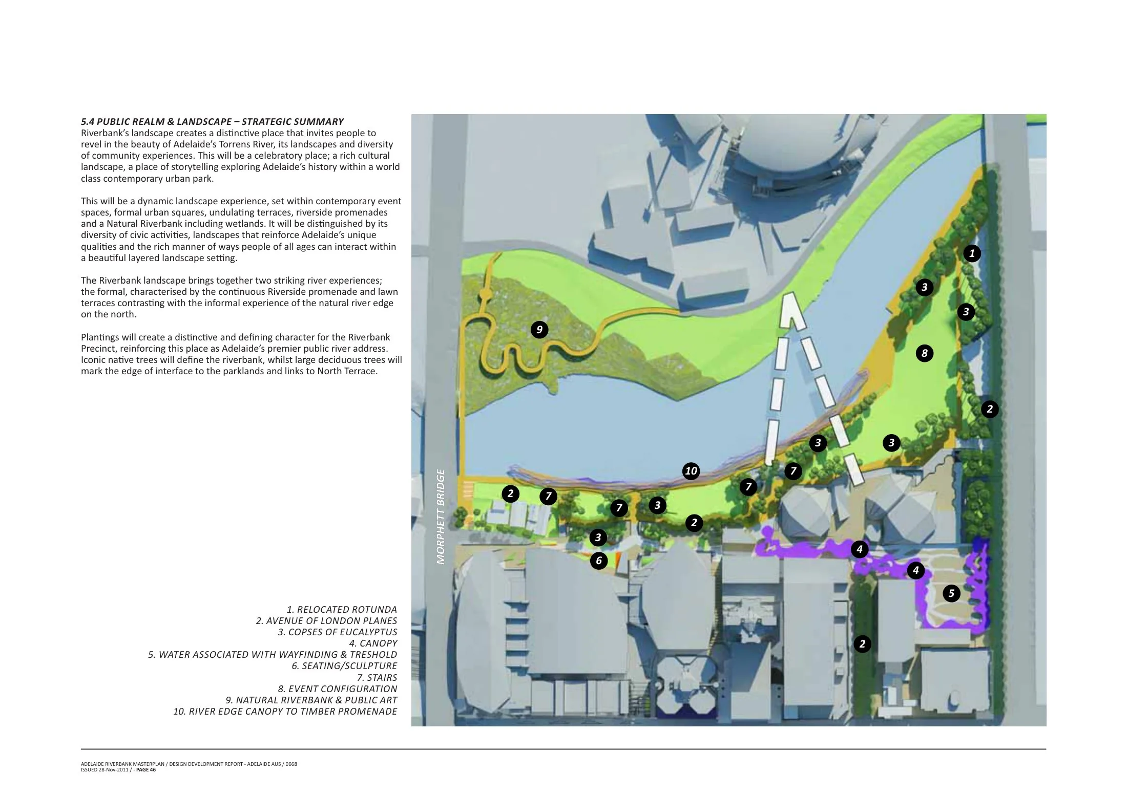
The Adelaide Riverbank Precinct plan, advanced by the South Australian Government from about 2013, is a precinct strategy for the strip of cultural, sporting, health and convention facilities along the River Torrens on the northern edge of Adelaide's city centre in Australia. It sought to knit together the Adelaide Oval, festival and convention centres, casino, new Royal Adelaide Hospital and biomedical precinct into a continuous, pedestrian-friendly riverfront spine, with the Torrens footbridge linking the Oval to the city, public-realm upgrades and staged redevelopment of key sites. Delivery has proceeded incrementally under a dedicated riverbank authority framework.
Significance
The Riverbank plan reflects the Australian state-government model of precinct-led city-centre renewal, using major public facilities and events infrastructure to construct a unified riverfront identity for a mid-sized capital. The redevelopment of Adelaide Oval and its footbridge is credited with revitalising the city centre's northern edge and event economy. It is cited in debates on stadium- and culture-led regeneration and on the governance of special-purpose precinct authorities.
What shaped it
- The linear park / greenway (1878 / 2009 revival)
- The public park (1843–1858)
- Landscape urbanism (Waldheim) (1997-2006)
Sources
- https://www.dit.sa.gov.au/__data/assets/pdf_file/0017/116702/Riverbank_Precinct_Fact_Sheet_Oct_2
- https://www.adelaide.edu.au/adelaidean/issues/45921/news46022.html