Auckland Wynyard Quarter Masterplan
Core idea
Harbor industrial lands to mixed-use
Why it matters
NZ benchmark waterfront regeneration
Description
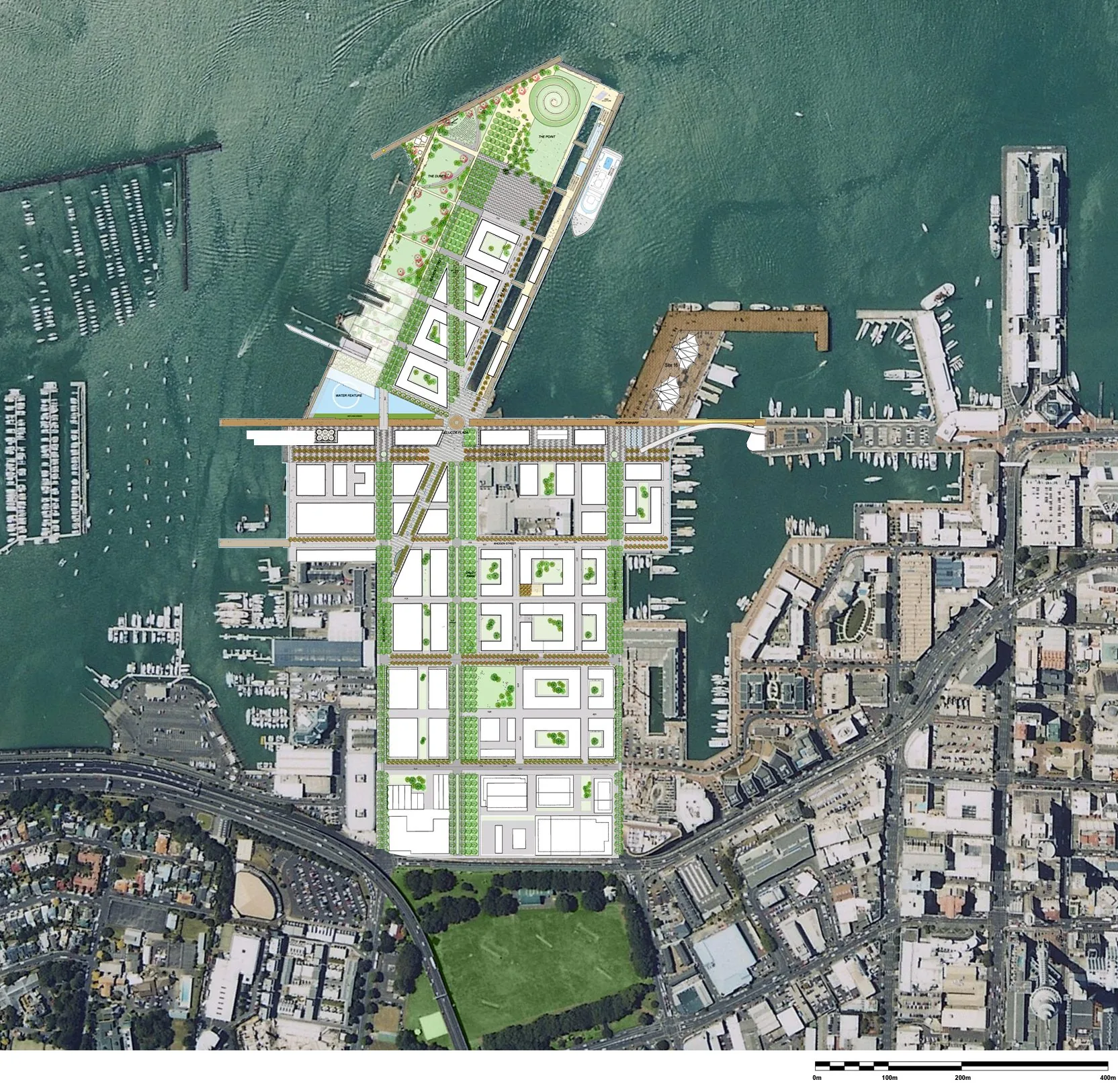
A masterplan for the Wynyard Quarter on Auckland's harbour edge, advanced from around 2012 by the city's waterfront development agency, later Panuku Development Auckland, with design input from practices including Jasmax and Architectus. The plan converts working harbour and marine industry land, including former tank farm areas, into a mixed-use quarter combining an innovation precinct, housing, headquarters offices and a sequence of public spaces such as waterfront promenades and event spaces. Implementation has proceeded in stages while retaining some marine industry activity.
Significance
Wynyard Quarter is New Zealand's benchmark waterfront regeneration, showing how an agency-led, staged masterplan can open a working harbour to public life without wholesale erasure of maritime uses. It is cited in Australasian debates on public-space-led regeneration and on the governance role of arms-length development agencies.
What shaped it
- Landscape urbanism (Waldheim) (1997-2006)
- Containerised-logistics scale-up (1970s–1990s)
- Transit-oriented development (TOD) (1993)
- Global financial crisis (2007–2009)
Sources
- https://architectus.co.nz/work/wynyard-quarter-urban-design-framework/
- https://www.panuku.co.nz/wynyard-quarter