Belur & Halebidu (Hoysala Capitals)
Core idea
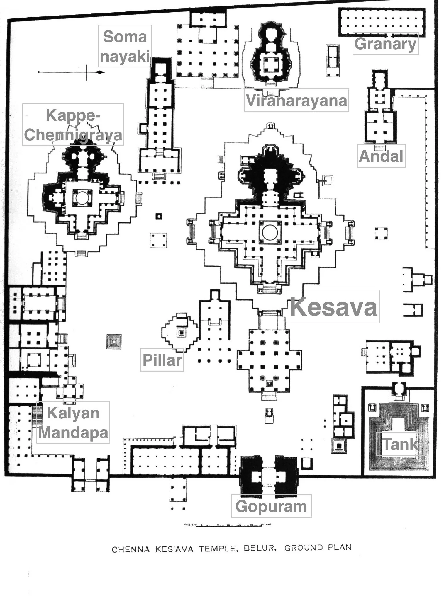
Twin temple-towns with stellate (star-shaped) temple platforms, walled compounds, and processional circuits — a non-orthogonal sacred geometry
Why it matters
Hoysala spatial grammar challenges the assumption that Indian temple-urbanism is always concentric or orthogonal; shows regional diversity in Hindu city-making
Description
Belur and Halebidu were the twin capitals of the Hoysala dynasty in southern Karnataka, developed between the eleventh and fourteenth centuries around the Chennakeshava and Hoysaleswara temples. Each town was organised as a temple settlement with stellate, star-shaped temple platforms, walled compounds, tanks and processional circuits structuring the surrounding urban fabric. The result was a sacred geometry that departed from the orthogonal and concentric layouts of other Indian temple cities.
Significance
The Hoysala capitals matter in planning history because they broaden the picture of Hindu temple-urbanism, showing that sacred city-making in India encompassed regionally distinct, non-orthogonal spatial grammars. They are frequently cited in scholarship questioning universal models of the cosmological city and highlighting the diversity of South Asian urban traditions.
What shaped it
- Hinduism & the Vedas (c. 1500 BCE onward)
Sources
- https://en.wikipedia.org/wiki/Halebidu
- https://www.deccan-heritage-foundation.org/heritage-sites/halebidu-and-belur/