Calicut (Kozhikode) — Zamorin Port-City
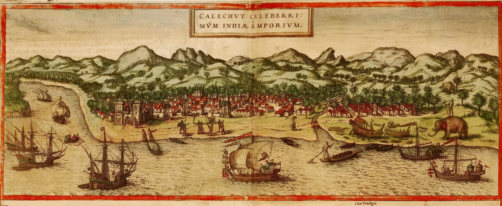
Core idea
Organically grown Zamorin spice-port on the Malabar coast.
Why it matters
Premier medieval Indian Ocean trade-city, the 'City of Spices'.
Description
Calicut, modern Kozhikode, rose from the thirteenth century when the Eradi rulers of Nediyiruppu made it the headquarters of the Zamorin (Samoothiri) dynasty. Built around the rulers' palace and the Tali temple, it became the leading port of the medieval Malabar coast and a cosmopolitan hub for Arab, Jewish, Persian, Chinese and later European merchants. Its fabric grew organically around a natural harbour and bustling marketplaces such as Valiyangadi (the Big Bazaar), rather than to any imposed plan. The city's commercial pre-eminence drew Vasco da Gama's fleet to nearby Kappad in 1498, opening the European sea route to India.
Significance
Calicut exemplifies the organically grown, merchant-driven port-city of the Indian Ocean world, where harbour, bazaar and palace structured an open, multi-ethnic trading settlement without a master plan. As the Zamorins' spice capital and the landfall of Vasco da Gama in 1498, it occupies a pivotal place in global urban and commercial history, embodying the cosmopolitan mercantile urbanism that European colonialism would later seek to control.
What shaped it
- Christianity & Islam (1st c. CE / 622 CE)
- Hinduism & the Vedas (c. 1500 BCE onward)