Chichén Itzá
Core idea
Ceremonial city organized around El Castillo pyramid, the Great Ballcourt, and a sacred cenote, blending Maya and central-Mexican planning
Why it matters
Demonstrates the fusion of two Mesoamerican traditions; astronomical alignment of monuments as urban-scale cosmology
Description
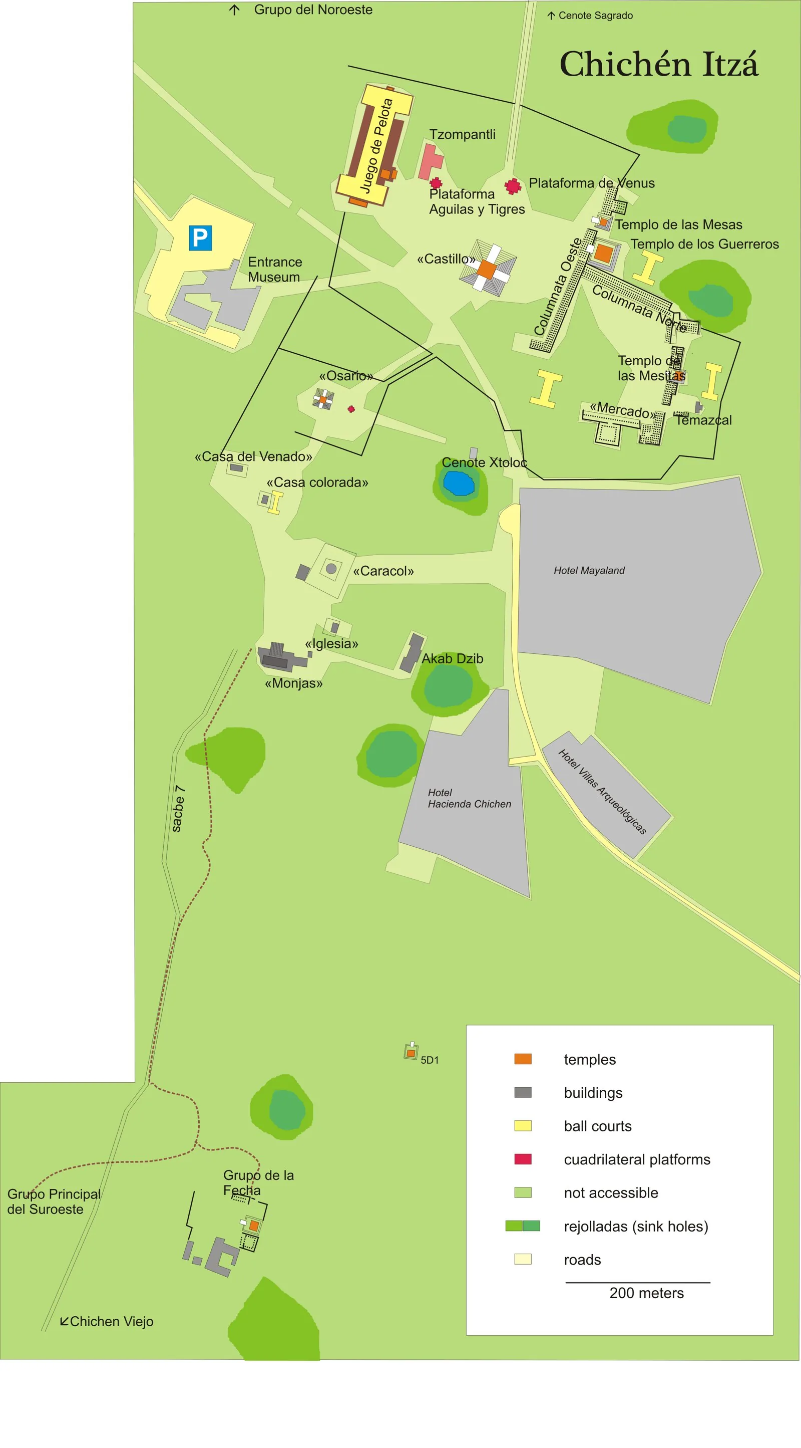
Chichén Itzá, in the Yucatán peninsula of present-day Mexico, developed between roughly 600 and 1200 CE as a major Maya city that later absorbed strong central-Mexican, Toltec-associated influences. The ceremonial core was organised around the stepped pyramid of El Castillo, the Great Ballcourt, the Temple of the Warriors and colonnaded halls, linked by raised causeways to the Sacred Cenote, a natural sinkhole used for offerings. Monuments were aligned with astronomical events, most famously the equinox serpent shadow on El Castillo.
Significance
Chichén Itzá demonstrates the fusion of Maya and central-Mexican planning traditions in a single urban ensemble, a hybridity that has long fuelled debate about migration, conquest and emulation in Mesoamerica. Its astronomical alignments show cosmology operating at the scale of city design, and as a UNESCO World Heritage site it remains one of the most studied examples of sacred urbanism in the Americas.
What became of it
A major Terminal Classic/Postclassic Maya centre that dominated northern Yucatan c. 600-1200; it declined as a political capital after c. 1200, was partly ruined and overgrown, and survives as an excavated archaeological and ceremonial site (UNESCO World Heritage).
Critique
The long-standing 'Toltec invasion' / Tula-Chichen diffusion model has been heavily critiqued, with many scholars now favouring overlapping chronologies and shared Mesoamerican networks rather than a one-way Central Mexican conquest.
What shaped it
- The Mesoamerican ceremonial centre and ballcourt (c. 500 BCE onward)
- The Maya Long Count calendar and cosmology (1st c. BCE onward)
- Kaogongji (Artificers' Record) (c. 5th c. BCE)
Plans it influenced
- Tenochtitlan (1325–1521)