Christchurch Central Recovery Plan (Blueprint)
Core idea
Post-earthquake anchors and frame
Why it matters
Resilient rebuild with public realm focus
Description
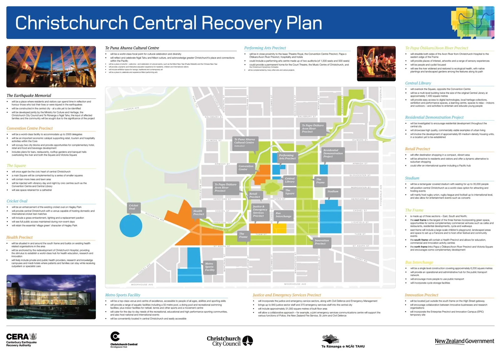
Christchurch's Central Recovery Plan ('Blueprint,' 2012), drawn up after devastating earthquakes, set a framework to rebuild the New Zealand city's centre with a compact core defined by anchor projects, green edges, and a lower, more resilient urban form.
Significance
The Christchurch Blueprint is a major case of post-disaster recovery planning, raising hard questions about the speed, top-down nature, and community role in rebuilding a destroyed city centre.
What became of it
Partly realised: the frame, Avon River precinct and several anchors (the bus interchange, Margaret Mahy playground, Te Pae convention centre) were built, but a decade on a number of anchor projects, including the stadium and metro sports facility, were delayed or still incomplete.
Critique
Criticised as an over-ambitious, top-down central-government blueprint whose anchor-project model slowed private rebuilding and left persistent gaps in the city centre.
What shaped it
- The Tōhoku earthquake & Fukushima (2011)
- Urban resilience (2013)
- Tactical urbanism (2010s)
- Seismic engineering (first seismic codes 1920s-1930s)
- Communicative & collaborative planning (1989-1997)
Plans it influenced
Sources
- https://en.wikipedia.org/wiki/Christchurch_Central_Recovery_Plan
- https://www.boffamiskell.co.nz/projects/christchurch-central-recovery-plan-blueprint