Copenhagen Finger Plan (2007 update)
Core idea
Reaffirmed rail ‘fingers’ with wedges
Why it matters
Longevity of transit–land use integration
Description
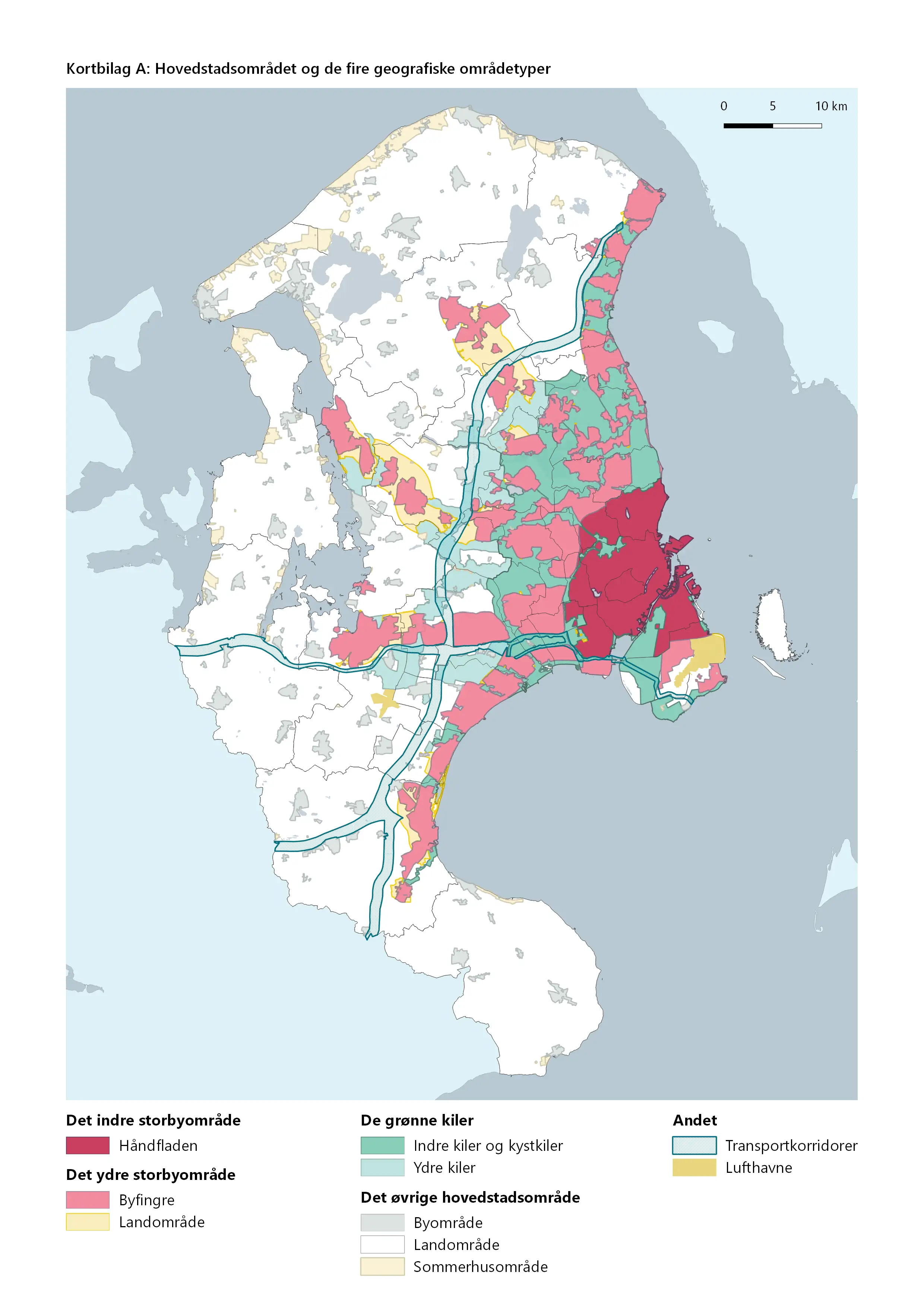
The 2007 Finger Plan is a national planning directive issued by the Danish state that gave statutory force to the celebrated 1947 plan for Greater Copenhagen. It reaffirms the metropolitan structure of urban 'fingers' extending along suburban rail lines from the palm of the central city, with protected green wedges between them, and introduced a station-proximity principle requiring large offices and institutions to locate close to rail stations. The directive binds municipal planning across the capital region within this inherited framework.
Significance
The 2007 update demonstrates the exceptional longevity of the Finger Plan, one of the most durable examples of transit–land use integration in planning history. By translating a sixty-year-old diagram into binding national regulation, it showed how a strong structural concept can survive shifting governance arrangements, and it remains a touchstone in international debates on metropolitan form, green wedge protection and transit-oriented regional planning.
What shaped it
- Transit-oriented development (TOD) (1993)
- The compact city (1973-1990s)
- The Transit Metropolis (Cervero) (1998)
Plans it influenced
- Copenhagen Nordhavn Masterplan (2008–)
Sources
- https://en.wikipedia.org/wiki/Finger_Plan
- https://academic.oup.com/book/42635/chapter/358102557
- https://www.tandfonline.com/doi/full/10.1080/13563475.2021.1945913