County of London Plan
Core idea
Comprehensive land-use/transport for London
Why it matters
Set stage for green belt and postwar renewal
Description
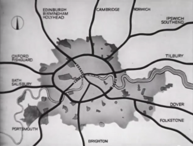
A comprehensive plan for the London County Council area prepared by Patrick Abercrombie and J. H. Forshaw, published in 1943 while the city was still under bombardment. It analysed London as a community of identifiable neighbourhoods and proposed decongestion of the inner districts, a ring-and-radial road system, segregation of industry, density zoning, and a coordinated open-space network. Together with Abercrombie's Greater London Plan of 1944 it framed reconstruction policy, including planned overspill to new towns beyond a green belt.
Significance
The County of London Plan is a foundational document of postwar British planning, translating survey-based analysis into a persuasive public programme and setting the stage for the green belt, the New Towns Act and comprehensive redevelopment. Its neighbourhood and density doctrines shaped decades of London policy and were widely emulated and debated across the Commonwealth and Europe.
What shaped it
- The Athens Charter (1933 / 1943)
- The green belt (1898 concept / 1938 law)
- Survey-before-plan (1915)
- Barlow Report & green-belt policy (1940)
- The Neighbourhood Unit (1929)
Plans it influenced
- Stevenage New Town (1946)
- Greater London Plan (1944)
- London Plan (GLA) (2004–2021)
Sources
- https://en.wikipedia.org/wiki/County_of_London_Plan
- https://www.udg.org.uk/publications/articles/county-london-plan-j-h-forshaw-and-patrick-abercrom