Hanoi Capital Construction Master Plan 2030/2050
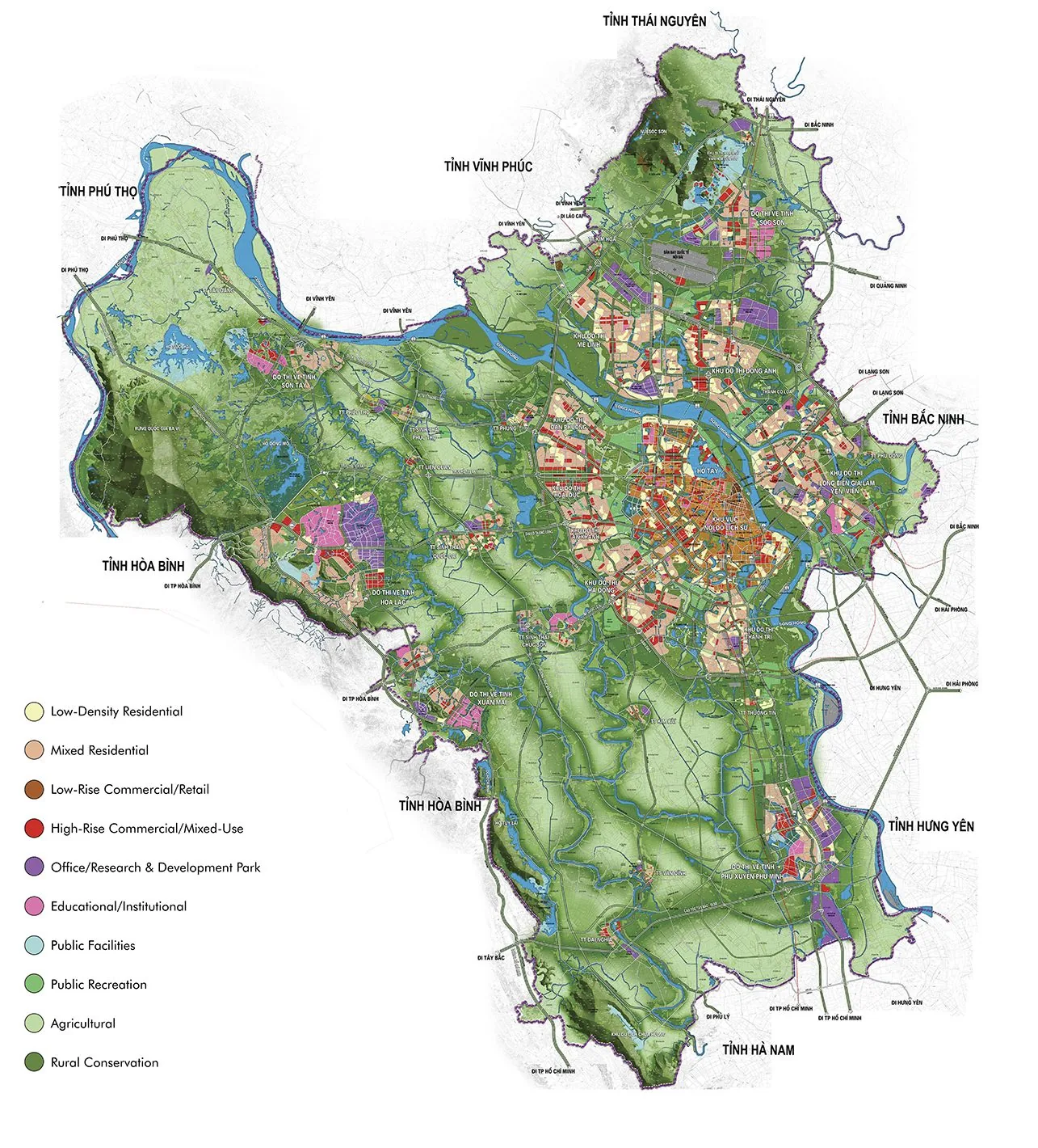
Core idea
Green corridors & satellite towns
Why it matters
Tames sprawl into structured polycentricity
Description
The Hanoi Capital Construction Master Plan 2030, with a vision to 2050, was approved by the Vietnamese government in 2011 after preparation under the Ministry of Construction with international consultants. It restructures the rapidly expanding capital as a polycentric region: a dense core city along the Red River, five satellite towns for industry, education and technology, and a broad green corridor of agricultural and flood land separating them. The plan followed the 2008 enlargement of Hanoi's administrative boundary, which had absorbed the former Ha Tay province, and set the framework for ring roads, metro lines and new urban areas at metropolitan scale.
Significance
The plan is a key example of state-led capital-city planning in reform-era Southeast Asia, attempting to tame speculative sprawl into a structured polycentric form. Its green-corridor concept has been widely discussed as a test of whether growth boundaries can hold under intense land-conversion pressure, and implementation has been uneven, with satellite towns developing more slowly than peripheral housing estates. It remains the reference framework against which Hanoi's subsequent adjustments and metro-led growth are debated.
What shaped it
- The green belt (1898 concept / 1938 law)
- Transit-oriented development (TOD) (1993)
- Garden Cities of To-Morrow (1898 / 1902)
Sources
- http://hanoi.org.vn/planning/en/archives/36
- https://www.viup.vn/en/Master-Planning-pla92-Hanoi-capital-construction-master-plan-to-2030-visi