Kano
Core idea
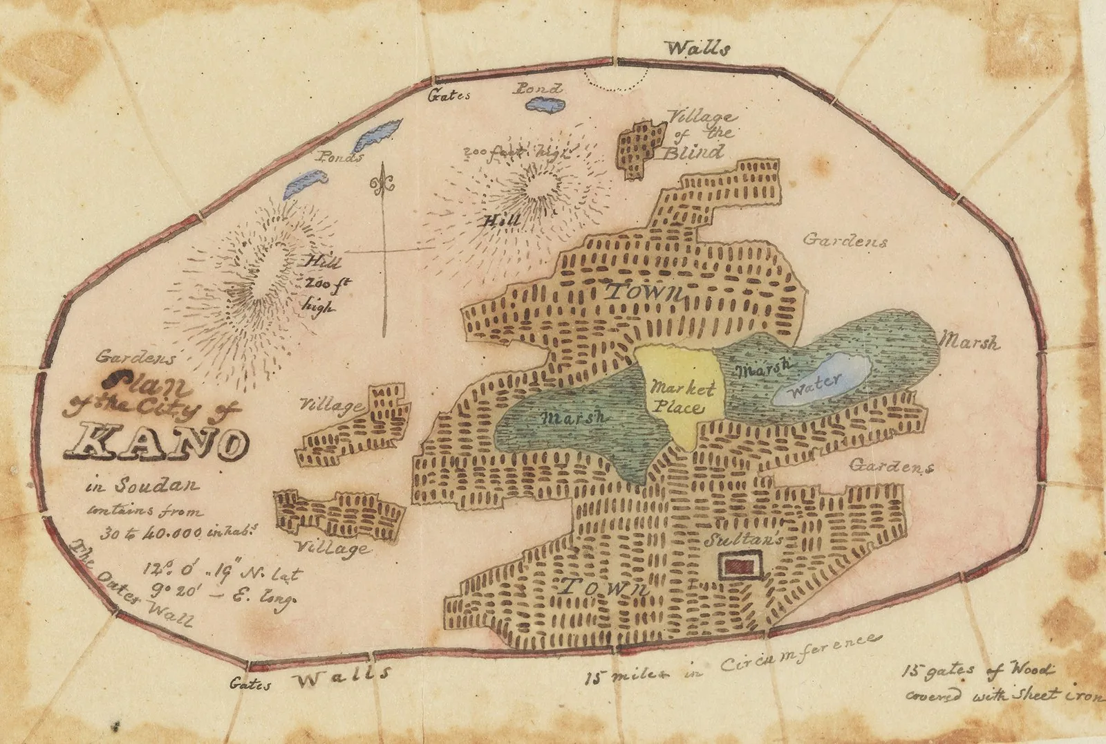
Walled Hausa trade city with ~14 km of earthen ramparts enclosing markets, dye-pits, farmland, and quarters — a self-provisioning urban territory
Why it matters
Major southern terminus of trans-Saharan trade; demonstrates the West African walled city-state model integrating agriculture within the walls
Description
Kano developed from the end of the eleventh century as one of the great Hausa city-states of northern Nigeria, its urban territory enclosed by monumental earthen ramparts extending for many kilometres. Within the walls lay markets, the famous indigo dye-pits, residential quarters and substantial areas of farmland, so that the city could largely provision itself. It served as a major southern terminus of the trans-Saharan caravan trade in leather, textiles and salt.
Significance
Kano exemplifies the West African walled city-state, a model of urbanism that integrated agriculture within the defensive perimeter and sustained itself over centuries. It is an important corrective to Eurocentric planning histories, showing large-scale, durable urban organisation in the Sahel driven by long-distance trade. Its walls and old city remain touchstones in the study of African urban form.
What shaped it
- The trans-Saharan gold-and-salt economy (c. 8th–16th c. CE)
- Christianity & Islam (1st c. CE / 622 CE)
Plans it influenced
- Benin City (c. 13th–15th c.)