Kumasi Structure Plan
Core idea
Ring roads, markets, green areas
Why it matters
Organizes rapid regional growth
Description
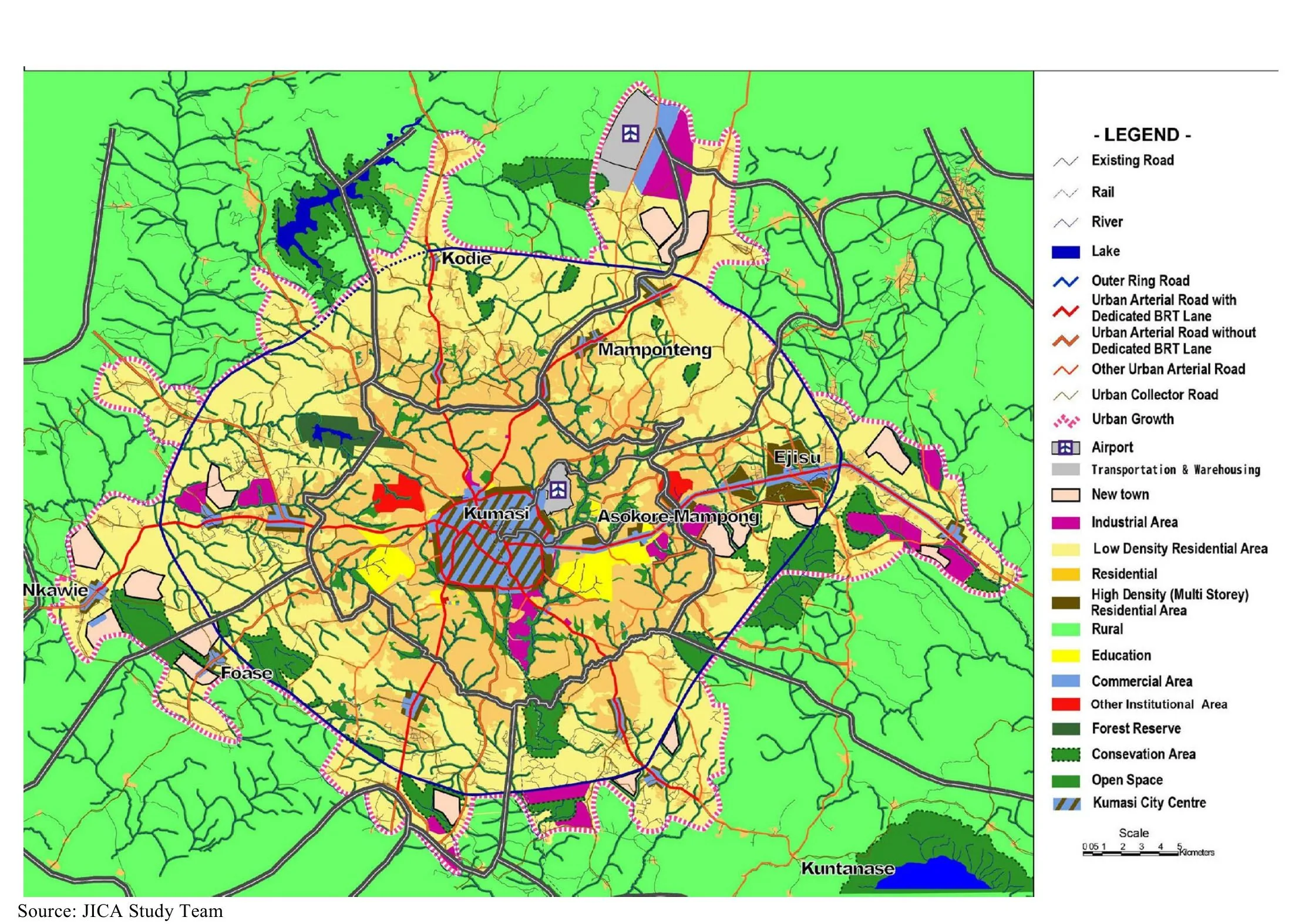
The Kumasi structure plan of 2013, prepared under Ghana's Town and Country Planning Department (TCPD) with the Kumasi Metropolitan Assembly as part of national planning reform, provides a spatial framework for Ghana's second city and the wider Greater Kumasi conurbation. It proposes ring and radial road improvements to relieve the congested central area, decongestion and reorganisation of the great Kejetia/Central Market complex and satellite markets, protection of green areas and remnants of Kumasi's 'garden city' landscape, and a polycentric pattern of sub-centres to structure rapid regional growth. It was developed with international technical assistance alongside a metropolitan spatial development framework.
Significance
The plan is representative of the new generation of sub-Saharan African structure plans that attempt to re-establish strategic spatial planning over fast-growing, largely informally developing city-regions. Focusing on markets, ring roads and green structure, it addresses the characteristic West African condition of a commerce-driven metropolis outgrowing its colonial-era plan. Its significance lies partly in the gap it exposes between framework planning and weak implementation capacity, a central theme in African planning debates.
What shaped it
- The master plan (early 20th c.)
- The green belt (1898 concept / 1938 law)
- Zoning (1884 Germany / 1916 NYC)
Plans it influenced
Sources
- https://luspa.gov.gh/wp-content/uploads/2023/11/EIJR13203-Kumasi_Vol.1-03.pdf
- https://link.springer.com/article/10.1007/s12132-015-9269-1